Locust Grove in Orange County, Virginia — The American South (Mid-Atlantic)
Orange County / Spotsylvania County
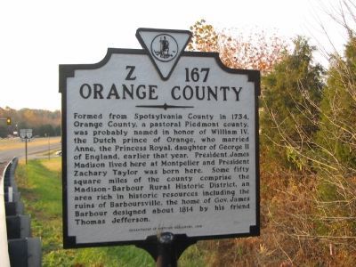
Orange County. Formed from Spotsylvania County in 1734, Orange County, a pastoral Piedmont county, was probably named in honor of William IV, the Dutch prince of Orange, who married Anne, the Princess Royal, daughter of George II of England, earlier that year. President James Madison lived here at Montpelier and President Zachary Taylor was born here. Some fifty square miles of the county comprise the Madison-Barbour Rural Historic District, and area rich in historic resources including the ruins of Barboursville, the home of Gov. James Barbour designed about 1814 by his friend Thomas Jefferson.
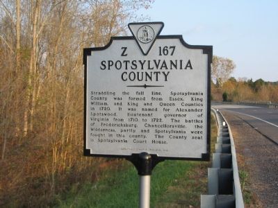
Spotsylvania County. Straddling the fall line, Spotsylvania County was formed from Essex, King William, and King and Queen Counties in 1720. It was named for Alexander Spotswood, lieutenant governor of Virginia from 1710 to 1722. The battles of Fredericksburg, Chancellorsville, the Wilderness, partly, and Spotsylvania were fought in this county. The County seat is Spotsylvania Court House.
Erected 1998 by Department of Historic Resources. (Marker Number Z-167.)
Topics and series. This historical marker is listed in these topic lists: Political Subdivisions • Settlements & Settlers • War, US Civil. In addition, it is included in the Former U.S. Presidents: #03 Thomas Jefferson, the Former U.S. Presidents: #04 James Madison, the Former U.S. Presidents: #12 Zachary Taylor, and the Virginia Department of Historic Resources (DHR) series lists. A significant historical year for this entry is 1734.
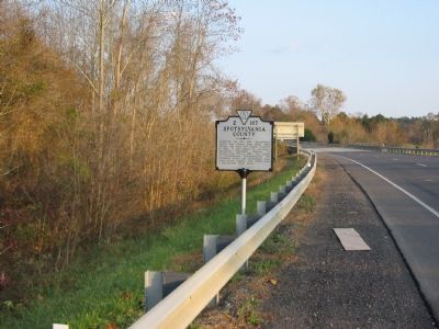
Location. 38° 19.57′ N, 77° 43.665′ W. Marker is in Locust Grove, Virginia, in Orange County. Marker is at the intersection of Germanna Highway (State Highway 3) and Constitution Highway (State Highway 20), on the right when traveling west on Germanna Highway. Located just past the Wilderness Run bridge. Touch for map. Marker is in this post office area: Locust Grove VA 22508, United States of America. Touch for directions.
Other nearby markers. At least 8 other markers are within walking distance of this marker. Landmark in the Wilderness (approx. 0.3 miles away); Old Wilderness Tavern (approx. 0.3 miles away); The Campaign of 1781 (approx. 0.3 miles away); Jackson’s Amputation (approx. 0.3 miles away); Grant’s Headquarters (approx. 0.4 miles away); An Uneasy Partnership (approx. 0.4 miles away); Grant Comes to Virginia (approx. 0.4 miles away); The Yard: A Busy Place (approx. half a mile away). Touch for a list and map of all markers in Locust Grove.
Regarding Orange County / Spotsylvania County. A "new" Z-series county line marker.
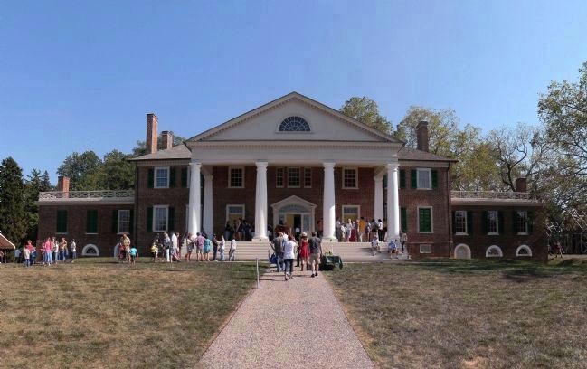
Photographed By PaulwC3, September 20, 2014
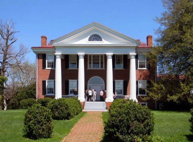
4. Montpelier (1764)
The home of President James Madison is one of the centerpiece estates of the Madison-Barbour Rural Historic District. Located near Montpelier Station, it was declared a National Historic Landmark in 1960 and listed on the National Register of Historic Places in 1966
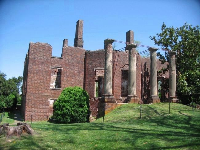
Photographed By Craig Swain, April 17, 2010
5. Barboursville (1822)
Designed by Thomas Jefferson and destroyed by fire in 1884, it is one of the centerpiece estates of the Madison-Barbour Rural Historic District. Located near Barboursville, it was listed on the National Register of Historic Places in 1969.
Credits. This page was last revised on July 8, 2021. It was originally submitted on December 20, 2007. This page has been viewed 1,165 times since then and 19 times this year. Last updated on November 5, 2020, by Bradley Owen of Morgantown, West Virginia. Photos: 1, 2, 3. submitted on December 20, 2007, by Craig Swain of Leesburg, Virginia. 4. submitted on September 22, 2014, by PaulwC3 of Northern, Virginia. 5. submitted on April 27, 2010, by Craig Swain of Leesburg, Virginia. 6, 7. submitted on April 20, 2013, by PaulwC3 of Northern, Virginia. • J. Makali Bruton was the editor who published this page.
