Brookfield in Waukesha County, Wisconsin — The American Midwest (Great Lakes)
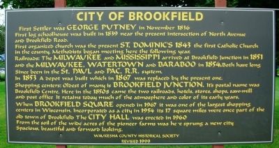
City of Brookfield
First organized church was the present St. Dominic’s 1843 the first Catholic Church in the county. Methodists began meeting here the following year.
Railroads: The Milwaukee and Mississippi arrived at Brookfield Junction in 1851 and the Milwaukee, Watertown and Baraboo in 1854. Both have long since been in the St. Paul and Pac. R.R. system. In 1853 a depot was built which in 1867 was replaced by the present one.
Shopping centers: Oldest of many is Brookfield Junction. It’s postal name was Brookfield Centre. Here in the 1850s came the two railroads, hotels, stores, shops, sawmill and post office. It retains today much of the atmosphere and color of its early years.
When Brookfield Square opened in 1967 it was one of the largest shopping centers in Wisconsin. Incorporated as a city in 1954 its 17 square miles were once part of the old Town of Brookfield. The City Hall was erected in 1960.
From the soil of the wide acres of the pioneer farms was here sprung a new city
Spacious, beautiful and forward looking.
Erected 1999. (Marker Number 02-03.)
Topics. This historical marker is listed in these topic lists: Notable Places • Settlements & Settlers. A significant historical month for this entry is November 1836.
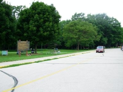
Location. 43° 3.975′ N, 88° 6.645′ W. Marker is in Brookfield, Wisconsin, in Waukesha County. Marker can be reached from Pilgrim Parkway just north of West North Avenue. Located in parking lot of Wirth Park. Touch for map. Marker is at or near this postal address: 2585 Pilgrim Pkwy, Brookfield WI 53005, United States of America. Touch for directions.
Other nearby markers. At least 8 other markers are within 4 miles of this marker, measured as the crow flies. Pioneer Cemetery (approx. 0.4 miles away); The William Donaldson House (approx. 1˝ miles away); Woodside One-Room School Bell (approx. 1˝ miles away); The Dousman Inn (approx. 1˝ miles away); Oak Hill Cemetery (approx. 2.1 miles away); Revolutionary War Veteran (approx. 2.1 miles away); a different marker also named Oak Hill Cemetery (approx. 3.1 miles away); Milwaukee County's First Airport (approx. 3.2 miles away). Touch for a list and map of all markers in Brookfield.
Credits. This page was last revised on October 25, 2021. It was originally submitted on July 15, 2010, by Paul Fehrenbach of Germantown, Wisconsin. This page has been viewed 1,428 times since then and 48 times this year. Last updated on October 25, 2021, by Linda Hansen of Waukesha, Wisconsin. Photos: 1, 2. submitted on July 15, 2010, by Paul Fehrenbach of Germantown, Wisconsin. • J. Makali Bruton was the editor who published this page.

