Near Brandy Station in Culpeper County, Virginia — The American South (Mid-Atlantic)
The Battle of Brandy Station
The Civil War in Culpeper County
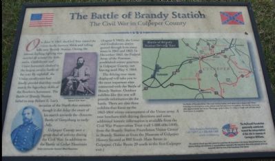
Culpeper County saw a great deal of activity during the Civil War. In addition to the Battle of Cedar Mountain (August 9, 1862), the Union and Confederate armies passed through here many times in 1862 and 1863. In December 1863, the Federal Army of the Potomac established winter quarters in Culpeper County, not leaving until May 4, 1864.
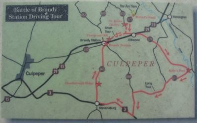
The driving tour route displayed will take you to the most important sites connected with the Battle of Brandy Station. Outdoor exhibits like this one will provide information on the battle. There are also three exhibits that focus on the 1863-1864 winter encampment of the Union Army. A tour brochure with driving directions and some additional historic information is available from the Civil War Preservation Trust (call 1-888-606-1400), from the Brandy Station Foundation Visitors Center in Brandy Station or from the Museum of Culpeper History located at 803 South Main Street in Culpeper. (Take Route 29 south to the first Culpeper exit.)
Help Preserve Battlefields • call CWPT at 1-888-606-1400 • www.civilwar.org • The Hallowell Foundation generously contributed toward the interpretation of this site in memory of Carrington Williams.
This material is based upon work assisted by a grant from the Department of the Interior, National Park Service. Any opinion, findings and conclusions or recommendations expressed in this material are those of the author(s) and do not necessarily reflect the views of the Department of the Interior.
Erected by Civil War Preservation Trust.
Topics and series. This historical marker is listed in this topic list: War, US Civil. In addition, it is included in the Battlefield Trails - Civil War series list. A significant historical date for this entry is May 4, 1998.
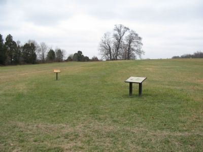
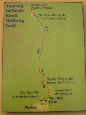
Location. 38° 31.979′ N, 77° 51.464′ W. Marker is near Brandy Station, Virginia, in Culpeper County. Marker is on Beverly Ford Road (County Route 676), on the right when traveling north. Located at the parking lot trail stop for the Buford's Knoll Walking Trail of the the Battle of Brandy Station.
Other nearby markers. At least 8 other markers are within walking distance of this marker. A different marker also named The Battle of Brandy Station (about 300 feet away, measured in a direct line); a different marker also named The Battle of Brandy Station (about 300 feet away); The 1863-64 Winter Encampment (approx. 0.6 miles away); a different marker also named The Battle of Brandy Station (approx. 0.6 miles away); a different marker also named The Battle of Brandy Station (approx. 0.7 miles away); a different marker also named The Battle of Brandy Station (approx. ¾ mile away); a different marker also named The Battle of Brandy Station (approx. ¾ mile away); a different marker also named The 1863-64 Winter Encampment (approx. 0.8 miles away). Touch for a list and map of all markers in Brandy Station.
More about this marker. On the left side of the marker are portraits of Gens. J.E.B. Stuart and Alfred Pleasonton. On the right is a map of the Brandy Station Driving Tour, "The Battle of Brandy Station, like most cavalry battles, took place over a large area. When following the driving tour route, please note that you have two options. The shorter route may take approximately two hours. The longer route is about 21 miles in length and will take about three hours to complete.
Regarding The Battle of Brandy Station. This is one of several markers interpreting the Battle of Brandy Station and the winter encampments of 1863-64 in Culpeper County. See the Battle of Brandy Station Virtual Tour by Markers linked below for additional related markers.
Related markers. Click here for a list of markers that are related to this marker. Battle of Brandy Station and Winter Encampment Virtual Tour by Markers.
Also see . . .
1. Brandy Station Foundation. Through the efforts of the Brandy Station Foundation, Civil War Preservation Trust, and other organizations, over 960 acres of this battlefield have been preserved. (Submitted on December 28, 2007, by Craig Swain of Leesburg, Virginia.)
2. Battle of Brandy Station Virtual Tour by Markers. A set markers that document the Battle of Brandy Station, June 9, 1863, and the Winter Encampment of 1863-64. Note the order of appearance is geographic and not chronologically aligned to the battle. (Submitted on January 1, 2008, by Craig Swain of Leesburg, Virginia.)
Photographed By Craig Swain, December 22, 2007
5. Battle of Brandy Station
Buford's Knoll Walking Trail
Buford's Knoll Walking Trail
Trailhead sign next to marker reads:
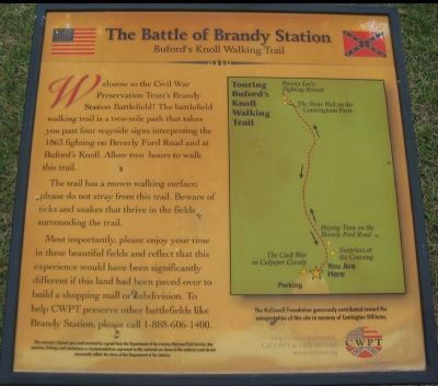
Welcome to the Civil War Preservation Trust's Brandy Station Battlefield! The battlefield walking trail is a two-mile path that takes you past four wayside signs interpreting the 1863 fighting on Beverly Ford Road and at Buford's Knoll. Allow two hours to walk the trail.
The trail has a mown walking surface; please do not stray from this trail. Beware of ticks and snakes that thrive in the fields surrounding the trail.
Most importantly, please enjoy your time in these beautiful fields and reflect that this experience would have been significantly different if this land had been paved over to build a shopping mall or subdivision. To help CWPT preserve other battlefields like Brandy Station, please call 1-888-606-1400.
Credits. This page was last revised on September 17, 2020. It was originally submitted on December 27, 2007. This page has been viewed 4,640 times since then and 33 times this year. Last updated on September 15, 2020, by Bradley Owen of Morgantown, West Virginia. Photos: 1. submitted on December 27, 2007, by Craig Swain of Leesburg, Virginia. 2. submitted on March 13, 2009, by Craig Swain of Leesburg, Virginia. 3. submitted on December 28, 2007, by Craig Swain of Leesburg, Virginia. 4. submitted on December 27, 2007, by Craig Swain of Leesburg, Virginia. 5, 6. submitted on December 28, 2007, by Craig Swain of Leesburg, Virginia. • J. Makali Bruton was the editor who published this page.
