Near Culpeper in Culpeper County, Virginia — The American South (Mid-Atlantic)
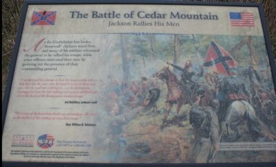
The Battle of Cedar Mountain
Jackson Rallies His Men
"I recollect well his attempt to draw his long cavalry sabre to help him stop the rout, when he found it so rusted from non use, that he could not withdraw it... so he deliberately unsnapped it from his belt holdings and used it scabbard and all on the heads of the fleeing panic stricken troops."
Jed Hotchkiss, Jackson's staff
"The escape of Jackson from death was miraculous. He was in the thickest of the combat, at very short range."
Gen. William B. Taliaferro
Help Preserve Battlefields, Call CWPT at 1-888-606-1400
Friends of Fredericksburg Area Battlefields - www.fofab.org
This material is based upon work assisted by a grant from the Department of the Interior, National Park Service. Any opinions, findings and conclusions or recommendations expressed in this material are those of the author(s) and do not necessarily reflect the views of the Department of the Interior.
Erected by Civil War Preservation Trust
Friends of Fredericksburg Area Battlefields.
Topics. This historical marker is listed in this topic list: War, US Civil.
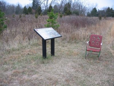
Location. Marker has been permanently removed. It was located near 38° 24.41′ N, 78° 4.027′ W. Marker was near Culpeper, Virginia, in Culpeper County. Marker could be reached from the intersection of General Winder Road (County Route 657) and James Madison Highway (U.S. 15), on the right when traveling west. Located at the fourth trail stop for the Civil War Preservation Trust's Cedar Mountain Battlefield walking trail. Touch for map. Marker was in this post office area: Culpeper VA 22701, United States of America.
We have been informed that this sign or monument is no longer there and will not be replaced. This page is an archival view of what was.
Other nearby markers. At least 8 other markers are within walking distance of this location. A different marker also named Battle of Cedar Mountain (within shouting distance of this marker); a different marker also named Battle of Cedar Mountain (about 300 feet away, measured in a direct line); a different marker also named Battle of Cedar Mountain (about 400 feet away); a different marker also named Battle of Cedar Mountain (about 600 feet away); a different marker also named The Battle of Cedar Mountain (about 800 feet away); a different marker also named Battle of Cedar Mountain (about 800 feet away); Hand-to-Hand Fighting (approx. 0.2 miles away); a different marker also named Battle of Cedar Mountain (approx. 0.2 miles away). Touch for a list and map of all markers in Culpeper.
More about this marker. On the left "'Stonewall' Jackson pulls his sword to rally his troops in the painting by Don Troiani entitled 'Jackson is With You' courtesy of Historical Art Prints, Ltd."
Regarding The Battle of Cedar Mountain. Since posting of this marker, the Friends of the Fredericksburg Area Battlefields web site has moved to www.parksonline.org/fofab/index.htm.
This is one of several markers interpreting the Battle of Cedar Mountain. See the Battle of Cedar Mountain Virtual Tour by Markers linked below.
Also see . . .
1. Battle of Cedar Mountain. National Park Service summary of the battle and driving tour. The marker is at the first tour stop. (Submitted on December 31, 2007, by Craig Swain of Leesburg, Virginia.)
2. Battle of Cedar Mountain. Short account of the battle, which was also called the Battle of Cedar Run and the Battle of Slaughter Mountain. The later after nearby resident Dr. Slaughter. (Submitted on January 1, 2008, by Craig Swain of Leesburg, Virginia.)
3. Battle of Cedar Mountain Virtual Tour by Markers. A set markers that document the Battle of Cedar Mountain, August 9, 1862. (Submitted on January 1, 2008, by Craig Swain of Leesburg, Virginia.)
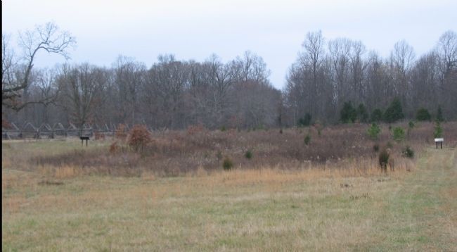
Photographed By Craig Swain, December 22, 2007
4. Trail Stops Two (left) and Four (right) Seen from the North.
At the time of the battle, this area was heavily wooded. Garnett's was driven from positions roughly in line with the two markers. Jackson would rally these men after they were driven from this line by Crawford's Federal Brigade.
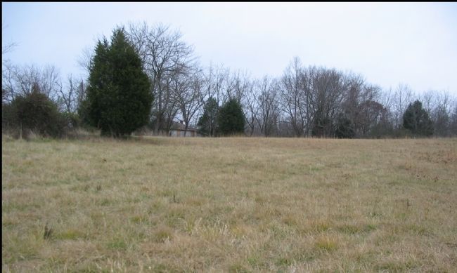
Photographed By Craig Swain, December 22, 2007
5. A.P. Hill's Division Arrives
From a point on the optional portion of the trail, looking south. The private house which stands inside the battlefield tract was built after the war. Arriving late in the afternoon, Hill's division was winded from an all day march. None-the-less, in a role he would repeat a month later at Antietam, Hill deployed his division from the march against an enemy poised on the verge of success. The first to deploy was Branch's Brigade of North Carolinians, which cleared the ground Crawford's Federals had taken earlier in the afternoon. Portions of Branch's Brigade advanced down this hill and continued to the north. On their left was Archer's Brigade, further supported by Ronald's and Pender's Brigades. The influx of Confederate reinforcements was too much for the Federals at this point.
Photographed By Craig Swain
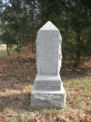
6. 3rd Wisconsin Monument
On the far end of the optional trail of the battlefield is this monument to the 3rd Wisconsin Infantry. The monument was erected in 1906 by survivors of the regiment. It lists the names of those killed or wounded from the regiment. The inscriptions have weathered with time and are difficult to read at present.
Credits. This page was last revised on October 21, 2021. It was originally submitted on December 31, 2007, by Craig Swain of Leesburg, Virginia. This page has been viewed 2,244 times since then and 23 times this year. Last updated on October 16, 2021, by Bradley Owen of Morgantown, West Virginia. Photos: 1. submitted on December 31, 2007, by Craig Swain of Leesburg, Virginia. 2. submitted on March 30, 2009, by Craig Swain of Leesburg, Virginia. 3, 4. submitted on December 31, 2007, by Craig Swain of Leesburg, Virginia. 5. submitted on January 1, 2008, by Craig Swain of Leesburg, Virginia. 6. submitted on January 13, 2008, by Craig Swain of Leesburg, Virginia. • Bernard Fisher was the editor who published this page.
