Near Fredericksburg in Stafford County, Virginia — The American South (Mid-Atlantic)
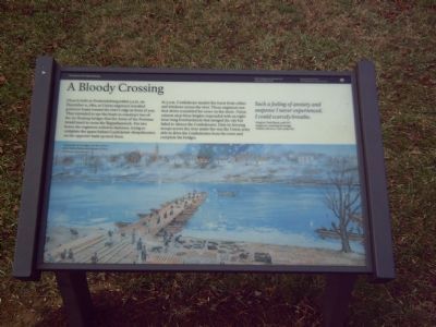
A Bloody Crossing
The Battle of Fredericksburg
— Fredericksburg and Spotsylvania National Military Park —
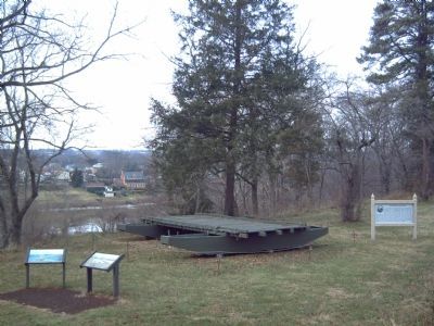
Church bells in Fredericksburg tolled 3 a.m. on December 11, 1862, as Union engineers wrestled pontoon boats toward the river's edge in front of you. They intended to use the boats to construct two of the six floating bridges that the Army of the Potomac would need to cross the Rappahannock. For two hours the engineers toiled in darkness, trying to complete the spans before Confederate sharpshooters on the opposite bank spotted them.
At 5 a.m. Confederate musket fire burst from cellars and windows across the river. Those engineers not shot down scrambled for cover on the shore. Union cannon atop these heights responded with an eight-hour-long bombardment that ravaged the city but failed to silence the Confederates. Only by ferrying troops across the river under fire was the Union army able to drive the Confederates from the town and complete the bridges.
Such a feeling of anxiety and suspense I never experienced. I could scarcely breathe.
Sergeant Clark Baurer, 50th NY Engineers, watching the bridge builders about to come under fire.
Erected 2007 by National Park Service, U.S. Department of the Interior.
Topics. This historical marker is listed in these topic lists: Military • Notable Events • War, US Civil • Waterways & Vessels. A significant historical date for this entry is December 11, 1862.
Location. 38° 18.493′ N, 77° 27.379′ W. Marker is near Fredericksburg, Virginia, in Stafford County. Marker can be reached from Chatham Lane. Marker is located at Chatham Manor, part of the Fredericksburg National Military Park. Touch for map. Marker is at or near this postal address: 120 Chatham Ln, Fredericksburg VA 22405, United States of America. Touch for directions.
Other nearby markers. At least 8 other markers are within walking distance of this marker. Pontoon Bridges (here, next to this marker); Between Battles (here, next to this marker); Bombardment (a few steps from this marker); Union Soldiers View (a few steps from this marker); Fredericksburg Campaign (a few steps from this marker); Beleaguered Town (a few steps from this marker); A “Picture of Desolation” (within shouting distance of this marker); Sow…Tend…Harvest (about 500 feet away, measured in a direct line). Touch for a list and map of all markers in Fredericksburg.
More about this marker. The painting, entitled Essayons: Engineers at Fredericksburg by Dale Gallon, depicts soldiers of the Fiftieth New York Engineers try unsuccessfully to complete their pontoon bridge under fire along the east bank of the Rappanhannock River
opposite Fredericksburg, Virginia, December 11, 1862. It is captioned, "Laying the two bridges cost the Union army twelve hours and dozens of lives."

Photographed By Craig Swain, December 13, 2008
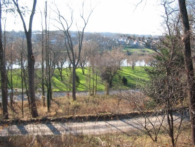
3. Upper Pontoon Crossing Site
Looking from the marker location down the slopes in front of Chatham. On the low ground near the Rappahannock, Federal engineers staged and assembled the pontoon bridge sections. The bridge extended from the Federal side across to a point on the distant far right of this photo.
Credits. This page was last revised on February 2, 2023. It was originally submitted on January 14, 2008, by Kevin W. of Stafford, Virginia. This page has been viewed 1,452 times since then and 16 times this year. Last updated on May 1, 2021, by Bradley Owen of Morgantown, West Virginia. Photos: 1, 2. submitted on January 14, 2008, by Kevin W. of Stafford, Virginia. 3. submitted on December 14, 2008, by Craig Swain of Leesburg, Virginia. • J. Makali Bruton was the editor who published this page.

