Kerman in Fresno County, California — The American West (Pacific Coastal)
Sycamore Point
Skaggs Bridge Park
Inscription.
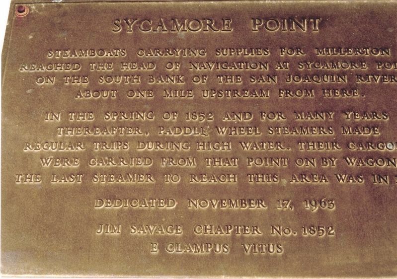
Steamboats carrying supplies for Millerton reached the head of navigation at Sycamore Point on the south bank of the San Joaquin River about one mile upstream from here. In the spring of 1852 and for many years thereafter paddle wheel steamers made regular trips during high water. Their cargoes were carried from that point on by wagon. The last steamer to reach this point was in 1911.
Erected 1963 by Jim Savage Chapter No. 1852, E Clampus Vitus. (Marker Number 5.)
Topics and series. This historical marker is listed in this topic list: Waterways & Vessels. In addition, it is included in the E Clampus Vitus series list. A significant historical year for this entry is 1852.
Location. Marker has been reported missing. It was located near 36° 49.333′ N, 120° 3.412′ W. Marker was in Kerman, California, in Fresno County. Marker could be reached from Madera Avenue (State Highway 145) 0.4 miles north of West Barstow Avenue. Touch for map. Marker was in this post office area: Kerman CA 93630, United States of America. Touch for directions.
Other nearby markers. At least 8 other markers are within 11 miles of this location, measured as the crow flies. Kerman (approx. 7 miles away); Borden Chinese Cemetery (approx. 7.1 miles away); a different marker also named Borden Chinese Cemetery (approx. 7.1 miles away); Madera Zoo (approx. 9˝ miles away); Madera County Library Service (approx. 9.6 miles away); Madera to Yosemite Stage Route (approx. 9.7 miles away); Forestiere Underground Gardens (approx. 9.8 miles away); John Charles Fremont (approx. 10.2 miles away).
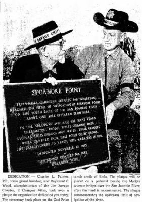
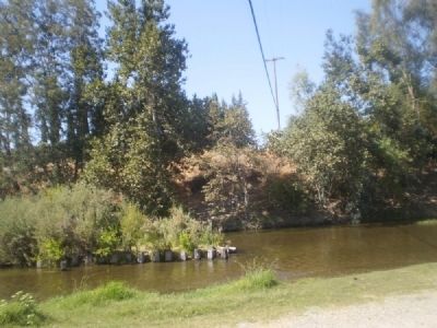
More about this marker. The actual location of Sycamore Point is upstream about a mile on private property. The brass marker commemorating Sycamore Point was affixed to a portion of the old Skaggs Bridge along the old path of Madera Avenue which had been destroyed by a flood years ago. The marker was apparently pried off by metal thieves.
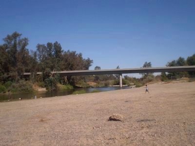
The portion of the old Skaggs Bridge that the marker was placed on is now gone as well. Additional flooding and the ravages of time have reduced the old bridge to various pieces of old concrete rubble. A modern bridge stands to the west of the old bridge.
Regarding Sycamore Point. The steamer J. R. McDonald continued to navigate the San Joaquin River up to Sycamore Point through 1911.
Also see . . . Skaggs Bridge Park. Fresno County Parks website entry (Submitted on November 5, 2021, by Larry Gertner of New York, New York.)
Credits. This page was last revised on March 19, 2024. It was originally submitted on September 21, 2011, by Lester J Letson of Fresno, California. This page has been viewed 1,469 times since then and 39 times this year. Last updated on July 29, 2023, by Ronald D. (Ron) Trigueiro of Fresno, California. Photos: 1. submitted on March 15, 2024, by Marilyn Felker of Kerman, California. 2. submitted on May 3, 2015, by Lester J Letson of Fresno, California. 3, 4. submitted on September 21, 2011, by Lester J Letson of Fresno, California. • Bill Pfingsten was the editor who published this page.
Editor’s want-list for this marker. Photo of the marker. • • Can you help?


