Taylor in Williamson County, Texas — The American South (West South Central)
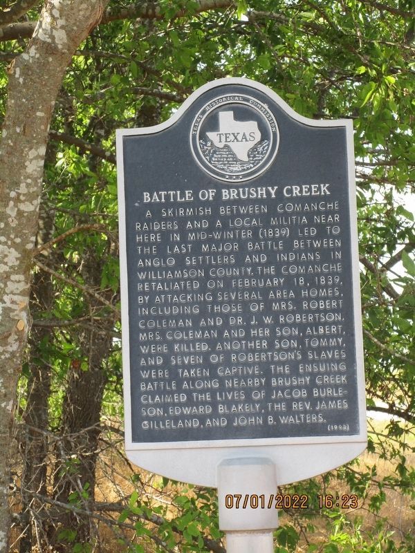
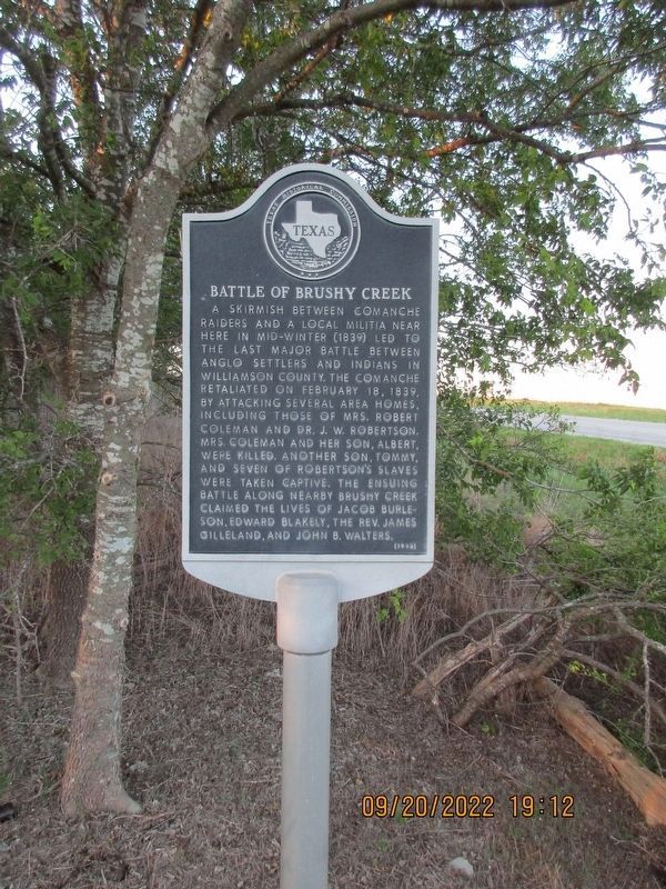
Battle of Brushy Creek
A skirmish between Comanche raiders and a local militia near here in mid-winter (1839) led to the last major battle between Anglo settlers and Indians in Williamson County. The Comanche retaliated on February 18, 1839, by attacking several area homes, including those of Mrs. Robert Coleman and Dr. J. W. Robertson. Mrs. Coleman and her son, Albert, were killed. Another son, Tommy, and seven of Robertson's slaves were taken captive. The ensuing battle along nearby Brushy Creek claimed the lives of Jacob Burleson, Edward Blakely, the Rev. James Gilleland, and John B. Walters.
Erected 1993 by Texas Historical Commission. (Marker Number 9037.)
Topics. This historical marker is listed in these topic lists: African Americans • Native Americans • Wars, US Indian. A significant historical month for this entry is February 1961.
Location. 30° 30.923′ N, 97° 23.835′ W. Marker is in Taylor, Texas, in Williamson County. Marker is on State Highway 95 south of County Road 452. The marker is on a dirt road on the east side of the highway just south of County Road 452. Touch for map. Marker is in this post office area: Taylor TX 76574, United States of America. Touch for directions.
Other nearby markers. At least 8 other markers are within 4 miles of this marker, measured as the crow flies. Howard Bland, Sr. (approx. 3.7 miles away); Taylor National Bank (approx. 3.8 miles away); First Baptist Church (approx. 3.8 miles away); United States Senator Morgan C. Hamilton (approx. 3.9 miles away); Eikel-Prewitt Building (approx. 3.9 miles away); Preslar-Hewitt Building (approx. 3.9 miles away); Taylor Post Office (approx. 3.9 miles away); Tex Avery (approx. 3.9 miles away). Touch for a list and map of all markers in Taylor.
Also see . . . Battle of Brushy Creek. Williamson County Historical Commission website entry (Submitted on September 7, 2023, by Larry Gertner of New York, New York.)
Credits. This page was last revised on September 7, 2023. It was originally submitted on September 9, 2007, by Keith Peterson of Cedar Park, Texas. This page has been viewed 3,974 times since then and 120 times this year. Last updated on July 11, 2022, by Joe Lotz of Denton, Texas. Photos: 1. submitted on May 21, 2023, by Jeff Leichsenring of Garland, Texas. 2. submitted on September 9, 2007, by Keith Peterson of Cedar Park, Texas. 3. submitted on November 12, 2022, by Jeff Leichsenring of Garland, Texas. • J. Makali Bruton was the editor who published this page.


