Oxon Hill in Prince George's County, Maryland — The American Northeast (Mid-Atlantic)
Sweet Sorghum
Oxon Hill Farm - Oxon Cove Park
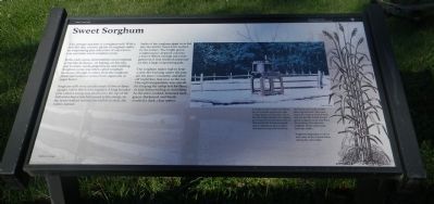
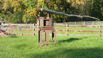
This antique machine is a sorghum mill. With a mill like this, a horse, plenty of sorghum stalks, an evaporating pan, and years of experience, you can make sweet sorghum syrup.
In the early 1900s, farm families used sorghum syrup like molasses – in baking, on biscuits, and to make candy, gingerbread, and pudding. Sorghum syrup was often called sorghum molasses (though it comes from the sorghum plant and molasses comes from sugarcane or sugar beets).
Sorghum mills were usually made of two or three upright rollers fitted close together. A long wooden pole called a sweep was attached to the top of the mill and a horse was harnessed to the sweep. As the horse walked around the mill in a circle, the rollers turned.
Stalks of the sorghum plant were fed into the mill by hand and crushed by the rollers. The bright green sorghum juice dripped out into a barrel. When enough juice was gathered, it was strained and poured into a large evaporating pan.
The sorghum maker had to keep a slow fire burning under the pan, stir the juice constantly, and skim off impurities that rose to the top. The right temperature was crucial for keeping the syrup hot for three or four hours boiling or scorching. As the juice cooked, it turned dark green, thickened, and finally reached a dark, clear amber.
Captions: A sorghum plant looks something like a cornstalk without the ears. A large cluster of tiny seeds sits at the top. Today, varieties of sorghum grow anywhere from about four to fifteen feet tall. Farmers usually plant sorghum in May or June and harvest near the first frost.
The leaves and seeds usually fatten up livestock. But some seeds also end up as bird food, and around the world people grind sorghum seeds into flour for cooking. The juice for sorghum syrup comes only from the stalks.
Sorghum originated in Africa and came to the United States during the slave trade.
[Drawing of the sorghum plant.]
[Background image of the rail fence surrounding the sorghum press by] Barbara S. Mogel
[Photo of the sorghum press by] Jon G. Dean
Erected by National Park Service, U.S. Department of the Interior.
Topics. This historical marker is listed in these topic lists: Agriculture • Colonial Era • Industry & Commerce.
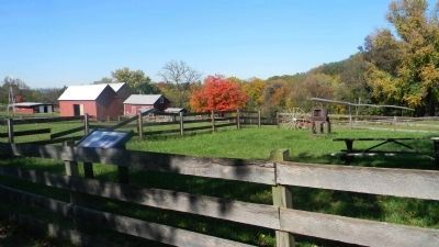
Location. 38° 48.08′ N, 77° 0.41′ W. Marker is in Oxon Hill, Maryland, in Prince George's County. Marker is on Oxon Hill Road west of Bald Eagle Road. Bald Eagle Road is accessible via Oxon Hill Road (MD 414), only - just west of Indian Head Hwy. (MD 210) on the south side of the Capital Beltway (I-95/495). Touch for map. Marker is at or near this postal address: 6411 Oxon Hill Rd, Oxon Hill MD 20745, United States of America. Touch for directions.
Other nearby markers. At least 8 other markers are within walking distance of this marker. Two Centuries of Farm Buildings (within shouting distance of this marker); Why a Brick Stable? (about 400 feet away, measured in a direct line); A Farm for St. Elizabeths, 1891-1950 (about 500 feet away); Wheat and Tobacco (about 500 feet away); A Voice Unheard… (about 500 feet away); Root Cellar (about 500 feet away); The Burning of Washington, D.C. (about 600 feet away); A Park with a Past (about 600 feet away). Touch for a list and map of all markers in Oxon Hill.
Also see . . .
1. ... the art of making Sweet Sorghum (sometimes called Sorghum Molasses)... American Sorghum website entry (Submitted on November 8, 2011, by Richard E. Miller of Oxon Hill, Maryland.)
2. Oxon Cove Park & Oxon Hill Farm. National Park Service website entry (Submitted on March 10, 2022, by Larry Gertner of New York, New York.)
Credits. This page was last revised on March 3, 2023. It was originally submitted on November 8, 2011, by Richard E. Miller of Oxon Hill, Maryland. This page has been viewed 993 times since then and 21 times this year. Last updated on March 24, 2022, by Connor Olson of Kewaskum, Wisconsin. Photos: 1, 2, 3. submitted on November 8, 2011, by Richard E. Miller of Oxon Hill, Maryland. • J. Makali Bruton was the editor who published this page.


