Near Harris in Chisago County, Minnesota — The American Midwest (Upper Plains)
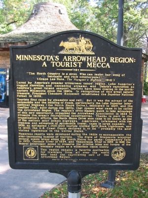
Minnesota's Arrowhead Region: A Tourist Mecca
"The North Country is a siren Who can resist her song of intricate and rich counterpoint?"
(Grace Lee Nute, The Voyageur's Highway, 1941)
Lured by America's premier wilderness canoe region, Lake Superior's rugged shoreline and cascading streams, and Duluth's reputation as America's great inland seaport, tourists have been coming to the northeastern Minnesota since the 1890s. In recognition of this great natural treasure, President Theodore Roosevelt established the Superior National Forest in 1909.
Tourists first came by steamship and rail. But it was the advent of the automobile and the building of roads, particularly the Lake Superior International Highway (the North Shore Drive), dedicated in 1925, and the Gunflint Trail, built during the 1920s, that opened what came to be called the Arrowhead Region. The region's civic leaders, quick to take advantage of this new opportunity, organized the Arrowhead Association in 1924 to promote the area's recreational opportunities. Thanks in part to the organization's efforts, the North Shore Drive soon came to be known as one of the nation's most scenic highways. Americans, infatuated with the freedom and adventure of automobile travel, came in large numbers. In 1938, an estimated 1,000,000 tourists visited Split Rock Lighthouse, and in 1940, the U.S. Coast Guard declared it to be "probably the most visited lighthouse in the United States."
Numerous resorts were developed during the 1920s to accommodate the ever-increasing number of tourists. The State of Minnesota acquired several scenic areas along the North Shore for parks: Gooseberry Falls in 1933, Cascade River in 1934, and Temperance River in 1936. In 1926 the federal government moved to preserve the pristine lakes and forests of the boundary region as a wilderness canoe county.
This region remains a favorite destination for travelers from all over the world who heed the captivating call of the Arrowhead Region.
Erected 1996 by the Minnesota Historical Society.
Topics and series. This historical marker is listed in these topic lists: Notable Places • Roads & Vehicles • Waterways & Vessels. In addition, it is included in the Former U.S. Presidents: #26 Theodore Roosevelt, and the Minnesota Historical Society series lists. A significant historical year for this entry is 1909.
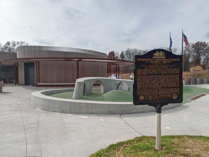
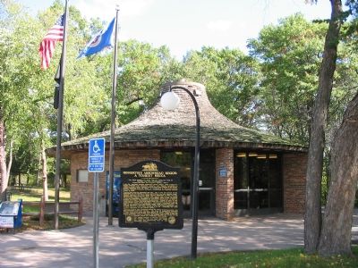
Location. 45° 35.949′ N, 92° 59.602′ W. Marker is near Harris, Minnesota, in Chisago County. Marker can be reached from Interstate 35 at milepost 154,, 1˝ miles Stark Road (County Road 10), on the right when traveling north. Marker is at northbound Goose Creek Rest Area, northwest
of Harris. Touch for map. Marker is in this post office area: Harris MN 55032, United States of America. Touch for directions.
Other nearby markers. At least 3 other markers are within 8 miles of this marker, measured as the crow flies. Arrow Line Railway (approx. 7.4 miles away); Richard Widmark's Birthsite, "Hollywood Legend!" (approx. 7.4 miles away); Frank O. Lowden "Almost a President"! (approx. 7.6 miles away).
Credits. This page was last revised on May 6, 2023. It was originally submitted on January 25, 2008, by Keith L of Wisconsin Rapids, Wisconsin. This page has been viewed 3,737 times since then and 34 times this year. Last updated on May 5, 2023, by John Neitz of Minneapolis, Minnesota. Photos: 1. submitted on January 25, 2008, by Keith L of Wisconsin Rapids, Wisconsin. 2. submitted on November 8, 2020, by John Neitz of Minneapolis, Minnesota. 3. submitted on January 25, 2008, by Keith L of Wisconsin Rapids, Wisconsin. • J. Makali Bruton was the editor who published this page.


