Bakersfield in Kern County, California — The American West (Pacific Coastal)
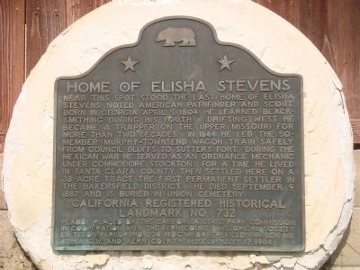
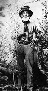
Home of Elisha Stevens
Erected 1964 by California State Park Commission in cooperation with the Kern County Historical Society, El Tejon Parlor No. 239, N.D.G.W., Bakersfield Parlor No. 42, N.S.G.W. and Kern County Museum. (Marker Number 732.)
Topics and series. This historical marker is listed in these topic lists: Exploration • Settlements & Settlers • War, Mexican-American. In addition, it is included in the California Historical Landmarks, and the Native Sons/Daughters of the Golden West series lists. A significant historical date for this entry is April 5, 1885.
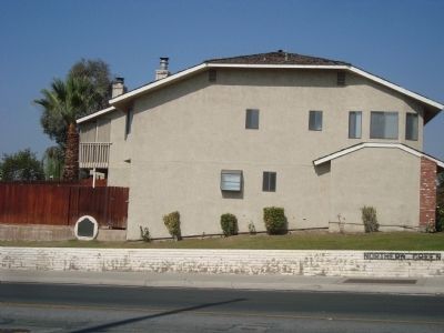
Location. 35° 23.838′ N, 119° 0.354′ W. Marker is in Bakersfield, California , in Kern County. Marker is at the intersection of West Columbus Street and Isla Verde Street, on the right when traveling west on West Columbus Street. Touch for map. Marker is at or near this postal address: 500 West Columbus Street, Bakersfield CA 93301, United States of America. Touch for directions.
Other nearby markers. At least 8 other markers are within walking distance of this marker. Jewett Family (approx. ¾ mile away); Beale Memorial Clock Tower (approx. 0.8 miles away); Kern County Chamber of Commerce (approx. 0.8 miles away); Bungalow (approx. 0.8 miles away); Howell House (approx. 0.8 miles away); Adobe House (approx. 0.8 miles away); Lόpez-Hill House (approx. 0.8 miles away); Standard School (approx. 0.8 miles away). Touch for a list and map of all markers in Bakersfield.
Regarding Home of Elisha Stevens. Elisha Stevens last name is correctly spelled Stephens.
Related markers. Click here for a list of markers that are related to this marker. The Stephens – Townsend – Murphy Party of 1844 marker in near Donner Lake
Credits. This page was last revised on September 1, 2023. It was originally submitted on December 7, 2011, by Barry Swackhamer of Brentwood, California. This page has been viewed 1,567 times since then and 39 times this year. Last updated on September 1, 2023, by Ronald D. (Ron) Trigueiro of Fresno, California. Photos: 1, 2, 3. submitted on December 7, 2011, by Barry Swackhamer of Brentwood, California. • J. Makali Bruton was the editor who published this page.


