Wrightsville in York County, Pennsylvania — The American Northeast (Mid-Atlantic)
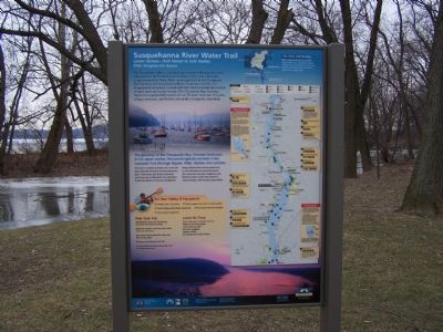
Susquehanna River Water Trail
Lower Section - York Haven to Safe Harbor
PFBC Wrightsville Access
The Susquehanna River is an American treasure reflecting the places and people of the Pennsylvania heartland. Enjoy your trip on the Susquehanna River Water Trail - an integral part of the Chesapeake Bay Gateways and Susquehanna River Greenway networks. The Susquehanna Greenway is a land and water based recreational corridor of open space and scenic byways. The Chesapeake Bay Gateways Network is a partnership system of over 20 water trails and 120 parks, refuges, museums, and historic sites in the Chesapeake watershed.
The gateway to the Chesapeake Bay. Forested landscape in the upper reaches. Renowned agricultural lands in the Lancaster-York Heritage Region. Wide, shallow river sections.
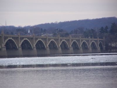
This region is marked by historic river towns and large reservoirs formed by the four hydroelectric dams - York Haven, Safe Harbor, Holtwood, and Conowingo (in Maryland). Area attractions include the historic Old Columbia-Wrightsville Bridge, Chickies Rock and Conejohela Flats, an internationally renowned bird habitat. River towns like Columbia, Wrightsville and Marietta actively market their commerce, unique heritage, and recreation opportunities.
Erected by Chesapeake Bay Gateway Network .
Topics. This historical marker is listed in these topic lists: Entertainment • Parks & Recreational Areas • Waterways & Vessels.
Location. 40° 1.421′ N, 76° 31.498′ W. Marker is in Wrightsville, Pennsylvania, in York County. Marker is on Maple Street, 0.1 miles east of S. Front Street. Touch for map. Marker is in this post office area: Wrightsville PA 17368, United States of America. Touch for directions.
Other nearby markers. At least 8 other markers are within walking distance of this marker. The Susquehanna and Tidewater Canal (here, next to this marker); a different marker also named Susquehanna and Tidewater Canal (about 600 feet away, measured in a direct line); Wrightsville, PA War Memorial (about 600 feet away); Susquehanna Canal (about 600 feet away); Veterans Memorial Bridge (approx. 0.2 miles away); American Legion Monument (approx. ¼ mile away); a different marker also named Wrightsville (approx. ¼ mile away); Gettysburg Campaign (approx. ¼ mile away). Touch for a list and map of all markers in Wrightsville.
More about this marker. Marker also found at York Furnace Boat Ramp in Lower Chanceford Township, Airville, PA 17302, elsewhere in this county.
Credits. This page was last revised on July 14, 2022. It was originally submitted on January 30, 2008, by Bill Pfingsten of Bel Air, Maryland. This page has been viewed 1,889 times since then and 8 times this year. Last updated on March 24, 2021, by Carl Gordon Moore Jr. of North East, Maryland. Photos: 1, 2. submitted on January 30, 2008, by Bill Pfingsten of Bel Air, Maryland.

