Court House in Arlington in Arlington County, Virginia — The American South (Mid-Atlantic)
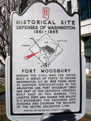
Fort Woodbury
Historical Site
— Defenses of Washington 1861 - 1865 —
Erected by Arlington County, Virginia. (Marker Number 11.)
Topics and series. This historical marker is listed in these topic lists: Forts and Castles • War, US Civil. In addition, it is included in the Defenses of Washington series list. A significant historical year for this entry is 1865.
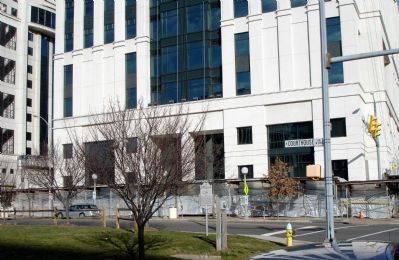
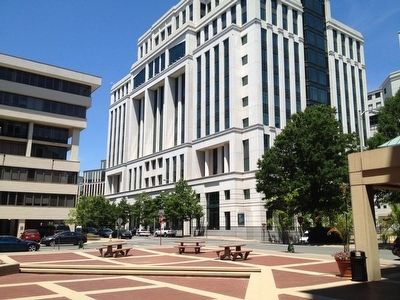
Location. 38° 53.385′ N, 77° 5.032′ W. Marker is in Arlington, Virginia, in Arlington County. It is in Court House. Marker is at the intersection of North Courthouse Road and North 14th Street, on the right when traveling south on North Courthouse Road. Touch for map. Marker is in this post office area: Arlington VA 22201, United States of America. Touch for directions.
Other nearby markers. At least 8 other markers are within walking distance of this marker. The Arlington Line (about 700 feet away, measured in a direct line); Fort Cass (approx. 0.3 miles away); John C. McKinney Memorial Stables (approx. half a mile away); Fort Strong (approx. half a mile away); Fort Myer Historic District (approx. half a mile away); The Commander in Chief's Oak (approx. half a mile away); 12th Pennsylvania Volunteer Infantry (approx. half a mile away); First Flight of an Airplane on a U.S. Army Installation (approx. 0.6 miles away). Touch for a list and map of all markers in Arlington.
More about this marker. In the center of the marker is a map of the Washington Defenses, with a red arrow pointing out the location of Fort Woodbury.
The original marker was worded slightly differently: Immediately behind the present Court House stood Fort Woodbury, a lunette in the Arlington Line constructed in August 1861. It had a perimeter of 275 yards and 19 emplacements for 13 guns. It was named for Major D.P. Woodbury, the Engineer who designed and constructed the Arlington Line.
Additional commentary.
1. Fort Woodbury Particulars
From "Mr. Lincoln's Forts: A Guide to the Civil War Defenses of Washington," by Benjamin Franklin Cooling III and Walton H. Owen II:
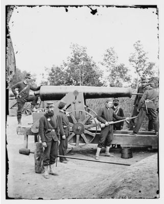
The fort was named for Brig. Gen. Daniel P. Woodbury, who died in August 1864 of yellow fever. The original fort stood at the intersection of 14th and Troy Streets, a block west of the marker. The fort's perimeter was 275 yards, with support for 13 guns. Armament included five 24-pdr guns, three 30-pdr Parrotts, four 6-pdr guns, and one 24-pdr Coehorn mortar. Other structures in the fort included two magazines and a fortified barracks.
Units stationed at Fort Woodbury at times during the war included the 97th New York Infantry, 1st Massachusetts Heavy Artillery, 145th Ohio Infantry, 16th Maine Infantry, and 88th Pennsylvania Infantry.
— Submitted February 4, 2008, by Craig Swain of Leesburg, Virginia.
Credits. This page was last revised on February 1, 2023. It was originally submitted on February 3, 2008. This page has been viewed 1,991 times since then and 50 times this year. Photos: 1, 2. submitted on February 3, 2008. 3. submitted on February 9, 2008. 4. submitted on June 10, 2012, by Kevin Vincent of Arlington, Virginia. • Craig Swain was the editor who published this page.


