Woodstock in Shenandoah County, Virginia — The American South (Mid-Atlantic)
Woodstock
Execution and “the Burning”
— 1864 Valley Campaign —
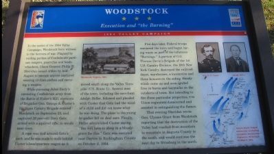
In the midst of the 1864 Valley Campaign, Woodstock bore witness to the horrors of war. Plagued by raiding parties of Confederate partisan rangers, guerrillas and bushwhackers, Union General Philip H. Sheridan issued orders by mid-August to execute anyone captured wearing civilian clothes and carrying a weapon.
While pursuing Jubal Early's retreating Confederate army from the Battle of Fisher's Hill, elements of Brigadier Gen. George A. Custer's Michigan Cavalry Brigade entered Woodstock on September 23, and captured 39 year-old Davy Getz, armed with a squirrel rifle, in the woods near town.
A rope was tied around Getz's neck, and he was made to walk behind Custer's headquarters wagon as it moved south along the Valley Turnpike (U.S. Route 11). Several men of the town, including merchant Adolph Heller, followed and pleaded with Custer that Getz had the mind of a child and did not know what he was doing. The pleas to the young brigadier fell on deaf ears. Finally, Heller admonished Custer saying, "You will have to sleep in a bloody grave for this." Getz was executed near Dayton in Rockingham County on October 2, 1864.
Five days later, Federal troops reentered the town and began laying waste as part of the infamous "Burnings." A portion of Col. Thomas Devin's Brigade of the 1st U.S. Cavalry Division, the 19th New York Cavalry, destroyed the railroad depot, warehouses, a locomotive and three boxcars on the siding. Steady winds came up and soon ignited fires in barns and haystacks on the outskirts of town. Not intending to fire those particular properties, two Union regiments dismounted and assisted in extinguishing the flames.
That evening Sheridan wrote Gen. Ulysses Grant from Woodstock reporting that the destruction of the Valley had reached from mountain to mountain in Augusta County to the south, and would continue the next day to Strasburg in the north.
Erected by Virginia Civil War Trails.
Topics and series. This historical marker is listed in this topic list: War, US Civil. In addition, it is included in the Former U.S. Presidents: #18 Ulysses S. Grant, and the Virginia Civil War Trails series lists. A significant historical month for this entry is September 1781.
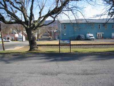
Location. Marker has been reported missing. It was located near 38° 53.001′ N, 78° 30.53′ W. Marker was in Woodstock, Virginia, in Shenandoah County. Marker was at the intersection of West Court Street and School Street, on the right when traveling east on West Court Street. Touch for map. Marker was in this post office area: Woodstock VA 22664, United States of America. Touch for directions.
Other nearby markers. At least 8 other markers are within walking distance of this location. Murphy House (about 700 feet away, measured in a direct line); Lieutenant Colonel A.S. "Sandie" Pendleton C.S.A. (about 700 feet away); Toms Brook (approx. 0.2 miles away); This Building of (approx. 0.2 miles away); Strasburg (approx. 0.2 miles away); Edinburg (approx. 0.2 miles away); Lest We Forget (approx. 0.2 miles away); John Peter Gabriel Muhlenberg (approx. 0.2 miles away). Touch for a list and map of all markers in Woodstock.
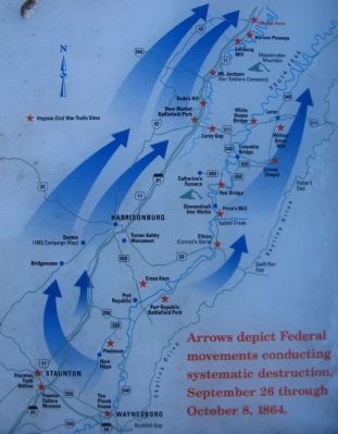
More about this marker. In the upper center is a drawing of "Woodstock, Virginia, 1864." On the right are portraits of Gen. G. A. Custer and Adolph Heller above a map depicting the Federal operations in the Valley during the "Burnings." "Arrows depict Federal movements conducing systematic destruction September 26 through October 8, 1864."
Additional keywords. The Burning
Credits. This page was last revised on February 2, 2023. It was originally submitted on December 17, 2007, by Craig Swain of Leesburg, Virginia. This page has been viewed 2,805 times since then and 59 times this year. Last updated on January 29, 2023. Photos: 1, 2, 3. submitted on December 17, 2007, by Craig Swain of Leesburg, Virginia. • Bernard Fisher was the editor who published this page.


