Alexandria in Fairfax County, Virginia — The American South (Mid-Atlantic)
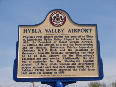
Hybla Valley Airport
Erected 2010 by Fairfax County History Commission.
Topics and series. This historical marker is listed in these topic lists: Air & Space • War, World II. In addition, it is included in the Virginia, Fairfax County History Commission series list. A significant historical month for this entry is February 1929.
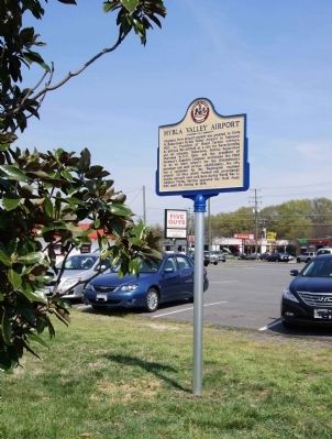
Location. 38° 44.994′ N, 77° 5.01′ W. Marker is in Alexandria, Virginia, in Fairfax County. Marker is at the intersection of Richmond Highway (U.S. 1) and Fordson Road, on the right when traveling south on Richmond Highway. Located in the landscaped grass strip at the south end of Five Guys retail location adjacent to Historic US Route 1. Touch for map. Marker is at or near this postal address: 7622 Richmond Hwy, Alexandria VA 22306, United States of America. Touch for directions.
Other nearby markers. At least 8 other markers are within walking distance of this marker. Gum Springs (about 600 feet away, measured in a direct line); West Ford (about 700 feet away); Woodlawn Methodist Church (approx. 0.2 miles away); Harper v. Virginia Board of Elections (approx. 0.2 miles away); Bethlehem Baptist Church (approx. 0.4 miles away); a different marker also named Gum Springs (approx. half a mile away); US Route 1 Wall of Aviation (approx. 0.6 miles away); Peake Family Cemetery (approx. 0.9 miles away). Touch for a list and map of all markers in Alexandria.
More about this marker. Marker Installed March 23, 2012.
Also see . . .
1. Hybla Valley Airport. (Submitted on March 24, 2012.)
2. Beacon Field Airport. (Submitted on March 24, 2012.)
Additional commentary.
1. Hybla Valley Airport Marker - Location
Marker is easiest to see from the 5 Guys restaurant parking lot.
— Submitted May 19, 2015, by Marty Smith of Stafford, Virginia.
Credits. This page was last revised on January 27, 2023. It was originally submitted on March 24, 2012, by Friends of Beacon Field Airport of Fairfax County, Virginia. This page has been viewed 2,665 times since then and 75 times this year. Last updated on January 4, 2022, by Carl Gordon Moore Jr. of North East, Maryland. Photos: 1, 2. submitted on March 24, 2012, by Friends of Beacon Field Airport of Fairfax County, Virginia. • Bernard Fisher was the editor who published this page.

