Lorain in Lorain County, Ohio — The American Midwest (Great Lakes)
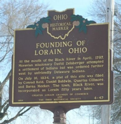
Founding of Lorain, Ohio
Erected 1984 by The Greater Lorain Chamber of Commerce, The Ohio Historical Society. (Marker Number 4-47.)
Topics and series. This historical marker is listed in these topic lists: Native Americans • Settlements & Settlers. In addition, it is included in the Ohio Historical Society / The Ohio History Connection series list. A significant historical month for this entry is April 1787.
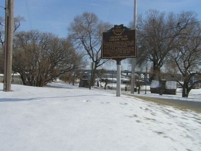
Location. 41° 28.279′ N, 82° 10.625′ W. Marker is in Lorain, Ohio, in Lorain County. Marker is at the intersection of Lakeside Avenue and Alabama Avenue, on the right when traveling west on Lakeside Avenue. Marker is on the east side of the Black River, near a boat ramp. From US 6 (East Erie Ave), east of the river (over the bridge) to Colorado Street (traffic light), north (towards the lake) to Lakeside Road, and left toward the marina. Touch for map. Marker is at or near this postal address: 110 Alabama Ave, Lorain OH 44052, United States of America. Touch for directions.
Other nearby markers. At least 8 other markers are within 2 miles of this marker, measured as the crow flies. Trading Post (a few steps from this marker); Lorain Station 100 (approx. ¼ mile away); Lorain West Breakwater Lighthouse / Saving the Lorain Lighthouse (approx. ¼ mile away); The Lorain Tornado, 1924 (approx. ¼ mile away); Shipbuilding (approx. 0.4 miles away); Lakeview Park War Memorial (approx. 1.2 miles away); Quincy A. Gillmore (approx. 1.2 miles away); General Quincy Adams Gillmore (approx. 1.2 miles away). Touch for a list and map of all markers in Lorain.
Additional keywords. American Indian, indigenous
Credits. This page was last revised on February 18, 2022. It was originally submitted on February 20, 2008, by Christopher Light of Valparaiso, Indiana. This page has been viewed 1,327 times since then and 39 times this year. Last updated on February 17, 2022, by Sundance of Lorain County, Ohio. Photos: 1, 2. submitted on February 20, 2008, by Christopher Light of Valparaiso, Indiana. • Devry Becker Jones was the editor who published this page.

