Marlborough in Middlesex County, Massachusetts — The American Northeast (New England)
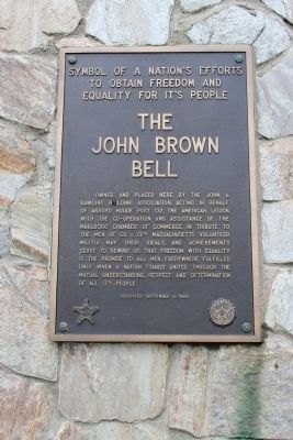
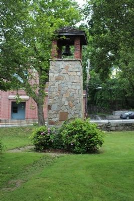
The John Brown Bell
Symbol of a nation's efforts to obtain freedom and equality for it's [sic] people
Erected 1968 by American Legion.
Topics and series. This historical marker is listed in these topic lists: Abolition & Underground RR • Civil Rights • War, US Civil. In addition, it is included in the Historic Bells series list.
Location. 42° 20.846′ N, 71° 32.729′ W. Marker is in Marlborough, Massachusetts, in Middlesex County. Marker is on Main Street, on the left when traveling east. Touch for map. Marker is in this post office area: Marlborough MA 01752, United States of America. Touch for directions.
Other nearby markers. At least 8 other markers are within 3 miles of this marker, measured as the crow flies. Gen. Henry Knox Trail (approx. 0.3 miles away); Doughboy Monument (approx. 0.3 miles away); High School Common (approx. 0.4 miles away); Robert W. "Red" Touchette (approx. 0.4 miles away); Lieut Wm. Munroe Brigham Jr. Park (approx. 0.4 miles away); The Volunteer (approx. 0.4 miles away); Williams Tavern (approx. one mile away); Olde Burial Grounds (approx. 2.9 miles away). Touch for a list and map of all markers in Marlborough.
Also see . . .
1. About John Brown. Wikipedia entry (Submitted on June 16, 2012, by Bryan Simmons of Attleboro, Massachusetts.)
2. The Taking of the John Brown Bell. The Marlborough Historical Society slideshow (Submitted on October 26, 2023, by Larry Gertner of New York, New York.)
Credits. This page was last revised on October 26, 2023. It was originally submitted on June 16, 2012. This page has been viewed 1,011 times since then and 33 times this year. Last updated on August 20, 2020, by Carl Scott Zimmerman of Kirkwood, Missouri. Photos: 1, 2. submitted on June 16, 2012, by Bryan Simmons of Attleboro, Massachusetts. • J. Makali Bruton was the editor who published this page.

