Woodbridge in Prince William County, Virginia — The American South (Mid-Atlantic)
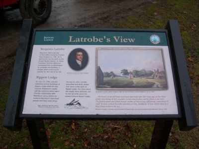
Latrobe's View
Rippon Lodge
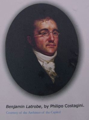
Benjamin Latrobe
Benjamin Henry Latrobe (1764-1820) moved to Virginia from England in 1796. He is best known for his work on the United States Capitol. In 1803, President Thomas Jefferson summoned him to Washington to complete the building, a project which preoccupied Latrobe for the rest of his life.
Rippon Lodge
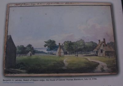
On July 13, 1796, Latrobe sketched several buildings at Rippon Lodge while he was Thomas Blackburn’s guest. Latrobe seems to have had a friendly relationship with Blackburn, since letters he wrote to Blackburn described people who they both knew.
During his visit, Latrobe described and drew wasps that lived in the walls at Rippon Lodge. His notes about the wasps were detailed, but he did not write about the people living at Rippon Lodge.
…The house on the left hand must have been built near 100 Years ago, as the oldest people now living do not remember to have heard when and by whom it was built. The family makes use of both houses, neither of them being sufficiently commodious of itself. It seems to have been the intention of Coln. Blackburn to have united them by a large Room between the two…
Benjamin Latrobe’s comments about his Sketch of Rippon Lodge, the House of Colonel Thomas Blackburn, July 13, 1796.
Erected 2007 by Prince William County.
Topics. This historical marker is listed in these topic lists: Animals • Arts, Letters, Music • Settlements & Settlers. A significant historical month for this entry is July 1935.
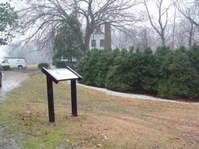
Location. 38° 36.892′ N, 77° 16.697′ W. Marker is in Woodbridge, Virginia, in Prince William County. Marker can be reached from Admiral Black Drive west of Blackburn Road, on the left when traveling west. The marker along the old Potomac Path, and between Rippon Lodge and the new visitor parking. Touch for map. Marker is at or near this postal address: 15520 Blackburn Road, Woodbridge VA 22191, United States of America. Touch for directions.
Other nearby markers. At least 8 other markers are within walking distance of this marker. Neabsco Creek (within shouting distance of this marker); Historic Landscape (within shouting distance of this marker); Centuries of History (within shouting distance of this marker); The Burying Ground (about 400 feet away, measured in a direct line); Stones, but No Bones (about 500 feet away); Collo. Richard Blackburn (about 700 feet away); Rippon Lodge (approx. 0.2 miles away); The Potomac Path (approx. 0.3 miles away). Touch for a list and map of all markers in Woodbridge.
More about this marker. In the lower center of the marker is a drawing of a Mud Wasp sketched in July 1796 by Benjamin Latrobe. It is entitled, Masons or Dirtdaubers
and provided for the marker courtesy of the Maryland Historical Society
Credits. This page was last revised on December 24, 2019. It was originally submitted on February 22, 2008, by Kevin W. of Stafford, Virginia. This page has been viewed 1,842 times since then and 25 times this year. Photos: 1, 2, 3, 4, 5. submitted on February 22, 2008, by Kevin W. of Stafford, Virginia.
