Eastport in Anne Arundel County, Maryland — The American Northeast (Mid-Atlantic)
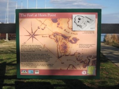
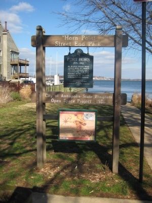
The Fort at Horn Point
Built in 1776, the fort had major defenses of trenches, earthen ramparts and fifteen cannons. In 1781, when Lafayette was stationed at Annapolis, his troops made the fort fully operational. The trenches provided cover for troop movements between the ramparts and the water's edge.
During the Civil War, the fort served as a hospital for Union soldiers recovering from smallpox. No trace of the fort remains today.
Text with upper-left photo: An artist's concept of the fort at Horn Point after 1794.
Text with main photo: Lafayette's troops camped some distance from the fort on Benjamin Ogle's Horn Point Farm, at the near end of the Spa Creek drawbridge.
Erected by Chesapeake Bay Gateways Network, Annapolis Maritime Museum, Four Rivers Garden Club.
Topics. This historical marker is listed in these topic lists: Colonial Era • Forts and Castles • War, US Civil • War, US Revolutionary. A significant historical year for this entry is 1776.
Location. Marker has been reported missing. It was located near 38° 58.386′ N, 76° 28.611′ W. Marker was in Eastport, Maryland, in Anne Arundel County. Marker was at the intersection of Chesapeake Avenue and Horn Point Drive, on the right when traveling east on Chesapeake Avenue. Touch for map. Marker was in this post office area: Annapolis MD 21403, United States of America. Touch for directions.
Other nearby markers. At least 8 other markers are within walking distance of this location. Murphy's Row (about 500 feet away, measured in a direct line); Eastport's Oldest House (about 700 feet away); The Glass Works (approx. 0.2 miles away); Three Great Boat Yards, One Location (approx. ¼ mile away); The Start of Something Big (approx. ¼ mile away); Deadrise Defined (approx. ¼ mile away); Eastport's Soul (approx. ¼ mile away); Harvesting the Bay (approx. ¼ mile away). Touch for a list and map of all markers in Eastport.
Regarding The Fort at Horn Point. The site of Fort Horn is actually one block south of the marker, at the end of Chester and Eastern avenues.
Credits. This page was last revised on May 3, 2023. It was originally submitted on February 24, 2008, by F. Robby of Baltimore, Maryland. This page has been viewed 2,180 times since then and 30 times this year. Last updated on May 21, 2021, by Andrea Parish of Waldorf, Maryland. Photos: 1, 2, 3. submitted on February 24, 2008, by F. Robby of Baltimore, Maryland. • J. Makali Bruton was the editor who published this page.


