Romney in Hampshire County, West Virginia — The American South (Appalachia)
Jackson's Headquarters
John B. White House
— Jackson's Bath-Romney Campaign —
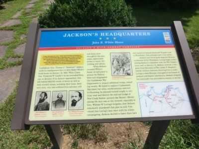
On January 1, 1862, Confederate Gen. Thomas J. "Stonewall" Jackson led four brigades west from Winchester, Va., to secure Romney in the fertile South Branch Valley on the North Western Turnpike. He attacked and occupied Bath on January 4 and shelled Hancock, Md.; he marched into Romney on January 14. Despite atrocious winter weather, Jackson's men destroyed telegraph lines and 100 miles of Baltimore and Ohio Railroad track. Leaving Gen. William W. Loring's brigades in Romney, Jackson led the Stonewall Brigade back to Winchester on January 23. Loring followed on January 31, and the Federals reoccupied Romney on February 7.
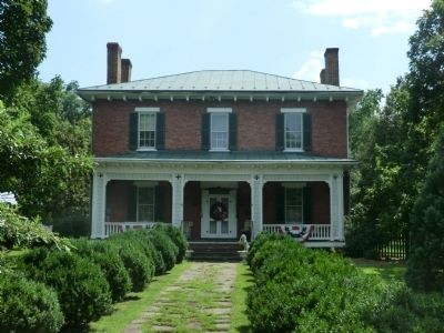
Confederate Gen. Thomas J. “Stonewall” Jackson made his headquarters here in John Baker White’s brick house on January 14, 1862. When Union Gen. Frederick W. Lander’s forces evacuated Romney on January 10 as Jackson approached, they left behind $60,000 worth of stores as well as fully stocked camps, including their tents. Jackson’s men, who had suffered from extreme cold and heavy snow throughout the campaign, appreciated access to warm, dry clothing and rations.
While Jackson occupied White’s house, he laid plans to pursue the Federal force and telegraphed the Confederate War Department to request additional troops, including cavalry. He hoped to capture Cumberland, Maryland, but when reinforcements were not forthcoming, he planned instead simply to continue west and destroy the railroad bridge at New Creek Station (present-day Keyser). Morale among the men was so low, however, especially in Gen. William W. Loring’s brigades, that Jackson reluctantly abandoned that plan as well. Convinced that Loring’s men were unfit for winter campaigning, Jackson decided to leave them here and march his beloved Stonewall Brigade back to Winchester, then perhaps lead it into action.
Jackson and the brigade departed Romney on January 23 for Winchester. Loring began undermining Jackson’s reputation with the War Department, and on January 31, Jackson received a telegram from Secretary of War Judah P. Benjamin outside military channels directing him to order Loring to leave Romney. Outraged at the breach of protocol and blatant interference, Jackson resigned but eventually was persuaded to remain in service.
Erected by West Virginia Civil War Trails.
Topics and series. This historical marker is listed in this topic list: War, US Civil. In addition, it is included in the West Virginia Civil War Trails series list. A significant historical month for this entry is January 1865.
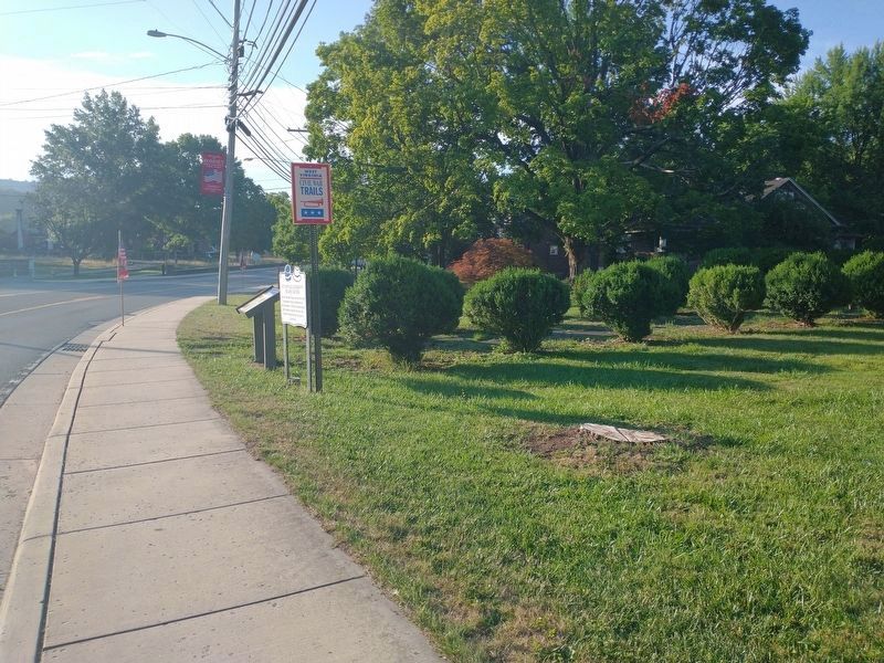
Location. 39° 20.454′ N, 78° 45.216′ W. Marker is in Romney, West Virginia, in Hampshire County. Marker is on Main Street (U.S. 50), on the right when traveling east. Touch for map. Marker is in this post office area: Romney WV 26757, United States of America. Touch for directions.
Other nearby markers. At least 8 other markers are within walking distance of this marker. Stonewall Jackson's Headquarters (a few steps from this marker); John J. Cornwell House (a few steps from this marker); W. Va School for the Deaf and Blind (within shouting distance of this marker); To Our Hero Dead In World War II (about 300 feet away, measured in a direct line); Veterans Memorial (about 300 feet away); Romney In The Civil War (about 400 feet away); Town of Romney (about 500 feet away); Grapeshot Among the Pines (about 600 feet away). Touch for a list and map of all markers in Romney.
Credits. This page was last revised on August 15, 2022. It was originally submitted on August 22, 2012, by Don Morfe of Baltimore, Maryland. This page has been viewed 1,059 times since then and 44 times this year. Last updated on November 4, 2020, by Bradley Owen of Morgantown, West Virginia. Photos: 1. submitted on August 22, 2012, by Don Morfe of Baltimore, Maryland. 2. submitted on August 12, 2022, by Craig Doda of Napoleon, Ohio. 3. submitted on August 22, 2012, by Don Morfe of Baltimore, Maryland. • Devry Becker Jones was the editor who published this page.


