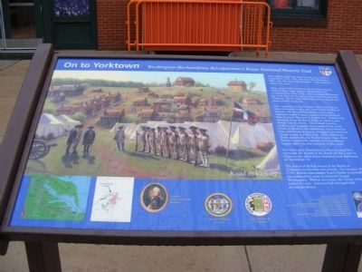
On To Yorktown
Washington-Rochambeau Revolutionary Route
— National Historic Trail —
Our nation never had more at risk than it did in September 1781. The American Revolutionary War—the War for independence—had raged for nearly six years.
More than 4,000 American and French troops, allied in their fight against the British, had marched from New York and inundated Baltimore for four days before advancing toward Yorktown, Virginia. At that time, Baltimore was a city of less than 10,000 residents.
One regiment, the Soissonnais of French forces, was encamped at this site. Across the harbor to the east, the Royal Deux-Ponts, a German regiment under France, camped along Harford Run (Central Avenue) in Jonestown. Others were situated along the Jones Falls, or what is not North Charles Street. The French Cavalry, artillery, and baggage train camped just to the north of Market, now Baltimore Street between Paca and Howard Streets. A brigade of American troops rested at Fells Point. Three Baltimore Town landmarks, St Paul’s Church (top), Fite’s Tavern (upper left) and the City Courthouse (upper right) are also featured in this scene.
Two days after hearing how a French naval fleet overcame the British at the Battle off the Capes in Virginia, the allied forces departed from Baltimore on September 15.
The defeat of British forces at the Battle of Yorktown in October was pivotal. On October
19, 1781, British commander Lord Charles Cornwallis surrendered his army to General George Washington. Within two years, the Treaty of Paris ended the War. America had emerged with its independence.Topics and series. This historical marker is listed in this topic list: War, US Revolutionary. In addition, it is included in the The Washington-Rochambeau Route series list. A significant historical month for this entry is September 1781.
Location. 39° 17.838′ N, 76° 37.14′ W. Marker is in Baltimore, Maryland. It is in Mount Vernon. The marker is near the Maryland Historical Society. Touch for map. Marker is at or near this postal address: 201 West Monument Street, Baltimore MD 21201, United States of America. Touch for directions.
Other nearby markers. At least 8 other markers are within walking distance of this marker. H. Irvine Keyser (a few steps from this marker); King Gambrinus, 1879 (a few steps from this marker); In Full Glory (within shouting distance of this marker); The Enoch Pratt House (within shouting distance of this marker); Maryland Historical Society (within shouting distance of this marker); Striving for Civil Liberties: The Progressives of Mount Vernon (within shouting distance of this marker); Grace and St. Peter's Church (within shouting distance of this marker); John Eagar Howard Memorial (about 400 feet away, measured in a direct line). Touch for a list and map of all markers in Baltimore.
Credits. This page was last revised on February 16, 2021. It was originally submitted on November 9, 2012, by Don Morfe of Baltimore, Maryland. This page has been viewed 713 times since then and 14 times this year. Last updated on February 7, 2021, by Carl Gordon Moore Jr. of North East, Maryland. Photo 1. submitted on November 9, 2012, by Don Morfe of Baltimore, Maryland. • Bill Pfingsten was the editor who published this page.
