Near Winchester in Frederick County, Virginia — The American South (Mid-Atlantic)
The Third Battle of Winchester
Thoburn's Attack
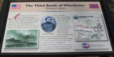
As the Nineteenth Corps tried to reorganize its lines, Union Col. Joseph Thoburn's division of the Eighth Army Corps came up from reserve and took position at the edge of the First Woods behind you. Union Gen. Philip Sheridan soon arrived and directed Thoburn to move forward as soon as the other division of the Eighth Corps (on the other side of Red Bud Run) was ready. About 3 p.m. "a mighty battle yell," from the other side of Red Bud Run announced the arrival of those troops and the entire Eighth Corps moved forward with elements of the Nineteenth Corps joining in. "For thirty minutes the battle that ensued was perfectly terrific," recalled one participant, "but then the forces in our front gave way, and in an instant we were over their works, and after them with yells and shouts of victory."
Erected 2008 by Civil War Preservation Trust.
Topics. This historical marker is listed in this topic list: War, US Civil.
Location. Marker has been reported permanently removed. It was located near 39° 11.907′ N, 78° 7.533′ W. Marker was near Winchester, Virginia, in Frederick County. Marker could be reached from Redbud Road, on the right when traveling east. Located at the Thoburn Attacks Wayside, along the Battle Trail, inside the CWPT Third Winchester Battlefield site. The closest access site is a trail head on the west side of the Frederick County School complex parking lot. Touch for map. Marker was in this post office area: Winchester VA 22603, United States of America.
We have been informed that this sign or monument is no longer there and will not be replaced. This page is an archival view of what was.
Other nearby markers. At least 8 other markers are within walking distance of this location. A Perfect Sheet Of Lead (a few steps from this marker); Maine (within shouting distance of this marker); Molineux's Stand (about 400 feet away, measured in a direct line); The Cost of Battle (about 400 feet away); Alabama (about 500 feet away); Ash Hollow (approx. 0.2 miles away); Ten Thousand Devils (approx. 0.2 miles away); The Middle Field (approx. 0.2 miles away). Touch for a list and map of all markers in Winchester.
More about this marker. On the lower left of the marker is a drawing captioned, Alfred Waud sketched this image of the Eighth Corps moving into position to attack Gordon's Division surrounding the Hackwood House. (Image courtesy of the Library of Congres.). In the center is a portrait of Colonel Joseph Thoburn, courtesy of USAMHI.)

Photographed By Craig Swain, March 15, 2008
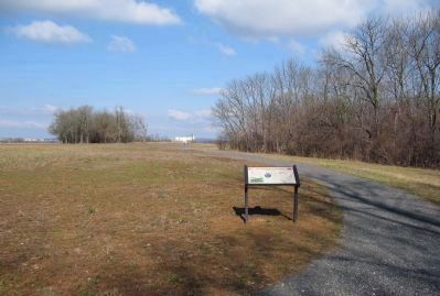
2. Thoburn Attacks Wayside
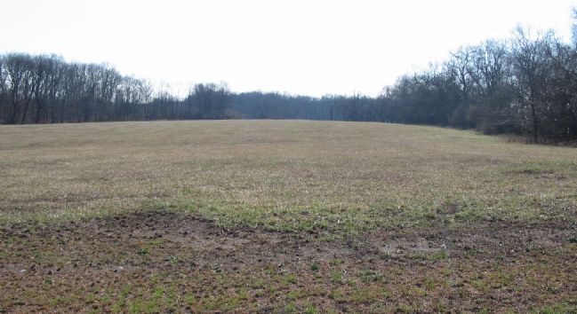
The large white building in the background is roughly northwest from the marker location. Hackwood stands in the same direction, but is just out of view below the ridge lines. Thoburn's attack was along that axis directed against the Confederate left.
Also see . . . Summary of the Battle of Third Winchester. The action described on the marker is covered under phase 8 of this National Parks Service summary. (Submitted on March 16, 2008, by Craig Swain of Leesburg, Virginia.)
Credits. This page was last revised on September 30, 2022. It was originally submitted on March 16, 2008, by Craig Swain of Leesburg, Virginia. This page has been viewed 3,357 times since then and 37 times this year. Last updated on February 26, 2021, by Bradley Owen of Morgantown, West Virginia. Photos: 1, 2, 3. submitted on March 16, 2008, by Craig Swain of Leesburg, Virginia. 4. submitted on October 27, 2007, by Craig Swain of Leesburg, Virginia. • Bill Pfingsten was the editor who published this page.


