Huntersville in Mecklenburg County, North Carolina — The American South (South Atlantic)
The Church Building
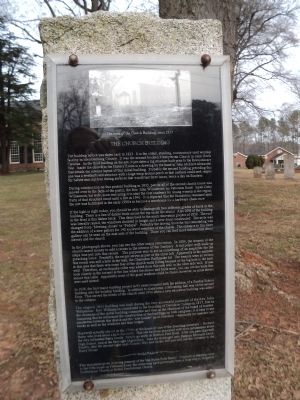
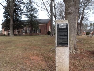
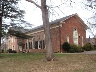
The building before you dates back to 1833. It is the oldest, standing, continuously used worship facility in Mecklenburg County. It was the second bricked Presbyterian Church in rural North Carolina. As the third building on the site, it pre-dates a log structure built prior to the Revolutionary War. Inside the church in the History Room is a drawing by the hand of John McKnitt Alexander that details the interior layout of this initial building. Probably the second building preceding this one was a weatherboard structure with a large wrap-around porch so that mothers could seek respite for babies and children during services that would last three hours, twice a day on Sundays.
During construction on this present building in 1833, part or all of the second church house was moved over to the farm of the pastor, the Rev. John Williamson, on Patterson Road. Sarah Doby Williamson, his wife, soon was using it to start the first academy for young women in the region. Parts of that structure stood until a fire in 1940. It is reported that the foundation remained until the site was bulldozed in the early 1990’s to become a warehouse for a hardware chain store.
If the light is right today, you should be able to distinguish two different grades of brick in the building. There is a line of darker bricks across the top under the stucco. Also 20% of the building in the front is this darker brick. This dates back to the main renovation project of 1859. The roof was literally raised, the windows doubled in height and a new front constructed. The style was changed from “Meeting House” to “Federal”. Probably the driving force for this remodeling was the addition of a new gallery for 142 enslaved members of the church. The entrance to this slave gallery can be seen on the east side of the building. There you can find more information about slavery and the church.
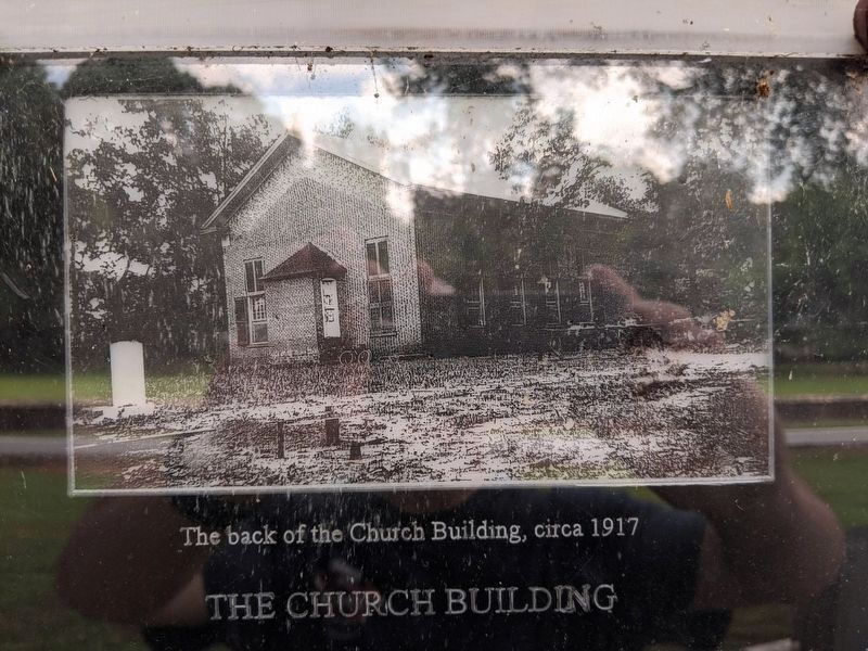
In the photograph above, you can see the other major renovation. In 1886, the women of the church raised money to add a recess to the interior of the Santuary. A tall pulpit with walk-up steps was put into this recess. The purpose was to act as something of an amplifier for the preaching voice. Presently, the recess serves as part of the church loft. Apparently at the moment this recess was still a hole in the wall, the Charleston Earthquake hit. The tremors were so serious in this area that there was some fear of the church walls falling because of the big hole in the back wall. Therefore, an earthquake cable was added from this side wall to the other side wall. If you look closely in the corners at the line where the stucco and brick meet, you can see the bolts that secure this cable. Apparently none of the giant washers
could be found, however, so plow shears were used instead.
In 1928, the first major building project in 95 years occurred with the addition of a Sunday School building onto the worship building. In addition to classrooms, a fellowship hall was on the second floor. This served the needs of the church until 1954 when a new education building was added to the campus.
The original 1833 building was built during the very successful pastorate of the Rev. John Williamson. Rev. Williamson contributed to the founding of Davidson College in 1837, first as the chairman of the initial building committee and then as the chairman of the board of trustees. Assuming that he influenced the construction of the buildings on both campuses, it is easy to see similarities between this church and the “row houses” up at Davidson – especially the masonry and bricks as well as the windows and their ledges.
Hopewell actually started in the 1750’s at the home of one of the founding members – Richard Barry, who lived about a mile due north. That site has been preserved with more information about the very influential Barry family. Simply go north on Beatties Ford Road. After you pass Hopewell High School, turn at the first right (April Mist). Take the third right onto Summer Serenade Drive. Finally, take the second right onto Coastal Way and on the left you will see the chimney to the Barry House.
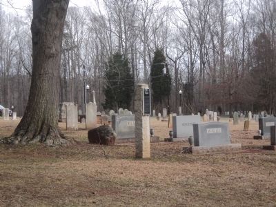
This monument given in loving memory of the Van Buren Potts family. Originally a stepping stone to the Potts house on Patterson Road, this stone may have previously been a front step to Hopewell Presbyterian Church or Bethel Presbyterian Church.
Topics. This historical marker is listed in this topic list: Churches & Religion. A significant historical year for this entry is 1833.
Location. 35° 21.957′ N, 80° 53.937′ W. Marker is in Huntersville, North Carolina, in Mecklenburg County. Marker is on Beaties Ford Road north of Sample Road, on the right when traveling north. Marker is located in front of the Hopewell Presbyterian Church. Touch for map. Marker is at or near this postal address: 10500 Beaties Ford Road, Huntersville NC 28078, United States of America. Touch for directions.
Other nearby markers. At least 8 other markers are within walking distance of this marker. William Lee Davidson (a few steps from this marker); In Memory of the Revolutionary War Patriots of Hopewell Presbyterian Church (a few steps from this marker); William Graham (within shouting distance of this marker); General William Lee Davidson (within shouting distance of this marker); Historic Latta Plantation (within shouting distance of this marker); “Upping Block” (within shouting distance of this marker); William Bain Alexander (within shouting distance of this marker); John McKnitt Alexander (within shouting distance of this marker). Touch for a list and map of all markers in Huntersville.
More about this marker. A photograph of “The back of the Church Building, circa 1917” appears at the top of the marker.
Credits. This page was last revised on July 6, 2020. It was originally submitted on February 12, 2013, by Bill Coughlin of Woodland Park, New Jersey. This page has been viewed 548 times since then and 15 times this year. Photos: 1, 2, 3, 4. submitted on February 12, 2013, by Bill Coughlin of Woodland Park, New Jersey. 5. submitted on July 6, 2020, by Mike Wintermantel of Pittsburgh, Pennsylvania.
