Cumberland Township near Gettysburg in Adams County, Pennsylvania — The American Northeast (Mid-Atlantic)
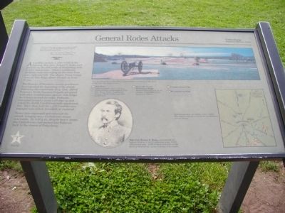
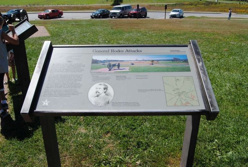
General Rodes Attacks
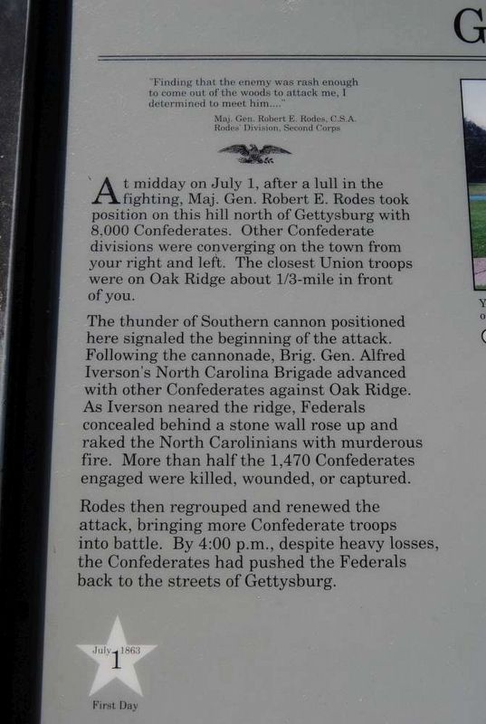
“Finding that the enemy was rash enough to come out of the woods to attack me, I determined to meet him…”
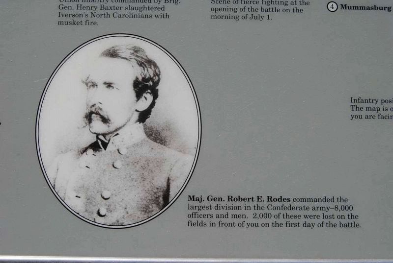
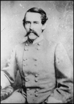
Maj. Gen. Robert E. Rodes, C.S.A
Rodes Division Second Corps
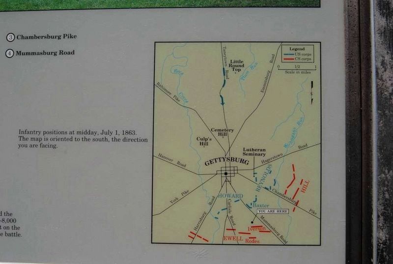
At midday on July 1, after a lull in the fighting, Maj. Gen. Robert E. Rodes took position on this hill north of Gettysburg with 8,000 Confederates. Other Confederate divisions were converging on the town from your right and left. The closest Union troops were on Oak Ridge about 1/3-mile in front of you.
The thunder of Southern cannon positioned here signaled the beginning of the attack. Following the cannonade, Brig. Gen. Alfred Iverson’s North Carolina Brigade advanced with other Confederates against Oak Ridge. As Iverson neared the ridge, Federals concealed behind a stone wall rose up and raked the North Carolinians with murderous fire. More than half then 1,470 Confederates engaged were killed, wounded, or captured.
Rodes then regrouped and renewed the attack, bringing more Confederate troops into battle. By 4:00 p.m., despite heavy losses, the Confederates had pushed the Federals back to the streets of Gettysburg.
(captions)
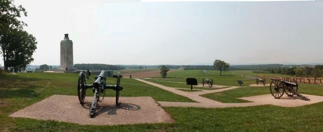
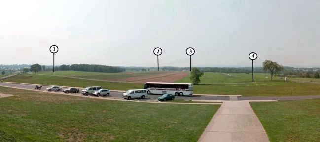
(top right) You are standing on Oak Hill looking south over much of the field of the first day of the battle.
1. Oak Ridge From behind the stone wall here, Union infantry commanded by Brig. Gen. Henry Baxter slaughtered Iverson’s North Carolinians with musket fire.
2. Reynolds Woods/McPherson Ridge Scene of fierce fighting at the opening of the battle on the morning of July 1.
3. Chambersburg Pike
4. Mummasburg Road
(lower left) Maj. Gen. Robert E. Rodes commanded the largest division in the Confederate army—8,000 officers and men. 2,000 of these were lost on the fields in front of you on the first day of the battle.
(lower right) Infantry positions at midday, July 1, 1863. The map is oriented to the south, the direction you are facing.
Erected by National Park Service.
Topics. This historical marker is listed in this topic list: War, US Civil. A significant historical date for this entry is July 1, 1863.
Location. This marker has been replaced by another marker nearby. It was located near 39° 50.895′ N, 77° 14.599′ W. Marker was near Gettysburg, Pennsylvania, in Adams County. It was in Cumberland Township. Marker was on Confederate Avenue, 0.1 miles south of Mummasburg Road, on the left when traveling east. Marker is located approximately 300 feet off road on battlefield path in Gettysburg National Military Park. Touch for map. Marker was in this post office area: Gettysburg PA 17325, United States of America. Touch for directions.
Other nearby markers. At least 8 other markers are within walking distance of this location. Rodes Attacks (here, next to this marker); Rodes's Division (a few steps from this marker); The Orange Artillery (a few steps from this marker); Eternal Light Peace Memorial (within shouting distance of this marker); a different marker also named Eternal Light Peace Memorial (within shouting distance of this marker); A Dedication (within shouting distance of this marker); Iverson's Brigade (within shouting distance of this marker); Carter's Battalion (within shouting distance of this marker). Touch for a list and map of all markers in Gettysburg.
Related markers. Click here for a list of markers that are related to this marker. Oak Hill markers and memorials.
Photographed By Bryan Olson, September 2007
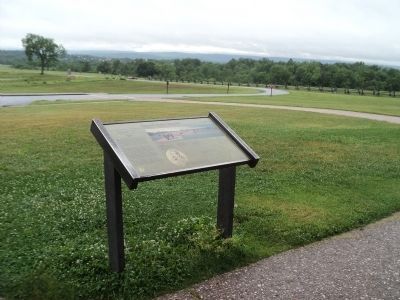
7. Oak Hill, looking South
1. Oak Ridge -From behind the stone wall here. Union infantry commanded by Brig. Gen. Henry Baxter slaughtered Iverson’s North Carolinians with musket fire.
2. Reynolds Woods/McPherson Ridge -Scene of fierce fighting at the opening of the battle on the morning of July 1.
3. Chambersburg Pike
4. Mummasburg Road
2. Reynolds Woods/McPherson Ridge -Scene of fierce fighting at the opening of the battle on the morning of July 1.
3. Chambersburg Pike
4. Mummasburg Road
Credits. This page was last revised on February 7, 2023. It was originally submitted on March 17, 2008, by Bryan Olson of Syracuse, New York. This page has been viewed 2,506 times since then and 30 times this year. Last updated on March 23, 2022, by Connor Olson of Kewaskum, Wisconsin. Photos: 1. submitted on March 17, 2008, by Bryan Olson of Syracuse, New York. 2. submitted on June 10, 2013, by Bill Coughlin of Woodland Park, New Jersey. 3, 4, 5, 6. submitted on July 21, 2016, by Brian Scott of Anderson, South Carolina. 7, 8, 9. submitted on March 17, 2008, by Bryan Olson of Syracuse, New York. • Bernard Fisher was the editor who published this page.
