Brackettville in Kinney County, Texas — The American South (West South Central)
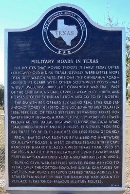
Military Roads in Texas
The Spanish era opened El Camino Real (the Old San Antonio Road) in 1691 to join Louisiana to Mexico. After 1836, Republic of Texas settlers demanded forts for safety from Indians; a main 1840 supply road followed present Austin-Dallas highway. Central National Road, 1844, linked Trinity and Red Rivers. (Its rules required all trees to be cut 12 inches or less from ground).
From 1848 to 1860, surveys by U.S. led to a network of military roads in west central Texas. In 1849, Capt. Randolph B. Marcy blazed a West Texas trail used by California gold hunters. Famed U.S. 2nd Cavalry made Ft. Belknap—San Antonio Road a military artery in 1850s.
During Civil War, supplies moved from Mexico to Texas over the Cotton Road. The Indian campaigns of Capt. R.S. Mackenzie in 1870s opened trails across the staked plains; but by 1881, the railroad had begun to replace Texas' once-famous military routes.
Erected 1968 by State Historical Survey Committee. (Marker Number 3377.)
Topics and series. This historical marker is listed in these topic lists: Industry & Commerce • Roads & Vehicles • Wars, US Indian. In addition, it is included in the Comanche Trail into Mexico, and the San Antonio-El Paso Road series lists.
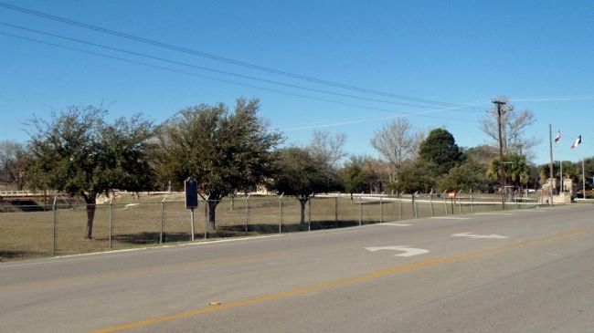
Location. 29° 18.481′ N, 100° 24.993′ W. Marker is in Brackettville, Texas, in Kinney County. Marker is at the intersection of East Military Highway (U.S. 90) and South Fort Street, on the right when traveling east on East Military Highway. Located 100 yards east of the entrance to Fort Clark Springs. Touch for map. Marker is at or near this postal address: 304 E Military St, Brackettville TX 78832, United States of America. Touch for directions.
Other nearby markers. At least 8 other markers are within walking distance of this marker. Fort Clark (about 700 feet away, measured in a direct line); Army Service Club (approx. 0.2 miles away); Petersen Building (approx. 0.2 miles away); Fort Clark Historic District (approx. 0.2 miles away); Juan A. Avila 1921-2008 (approx. 0.2 miles away); Officers' Club Open Mess (approx. 0.2 miles away); New Cavalry Barracks (approx. ¼ mile away); Las Moras Masonic Lodge Building (approx. ¼ mile away). Touch for a list and map of all markers in Brackettville.
Regarding Military Roads in Texas. Some of the
marker information is inaccurate. Captain Randolf B. Marcy had nothing to do with the estabishment of the Chihuahua road, or more accurately the "Lower Road." That honor belongs to then Colonel Joseph E. Johnston (later General, CSA) who lead the "great train" of 275 wagons and 2,500 animals from San Antonio to El Paso in the summer of 1849, literally building the road as he went. In addition, Ranald Slidell Mackenzie was a Brevet Brigadier General during his duty in Texas, not a Captain.
Credits. This page was last revised on October 20, 2023. It was originally submitted on February 13, 2013, by William F Haenn of Fort Clark (Brackettville), Texas. This page has been viewed 758 times since then and 50 times this year. Last updated on October 18, 2023, by Jeff Leichsenring of Garland, Texas. Photos: 1, 2. submitted on February 13, 2013, by William F Haenn of Fort Clark (Brackettville), Texas. • James Hulse was the editor who published this page.

