Havre de Grace in Harford County, Maryland — The American Northeast (Mid-Atlantic)
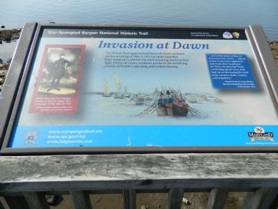
Invasion at Dawn
Star-Spangled Banner National Historic Trail
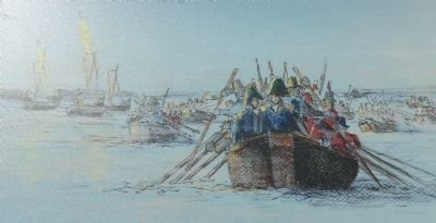
"...just at the dawn of day, he discovered four boats...(About sixteen boats) then appeared...and made their landing at the Point, the first four boats continuing up the river, and kept up an increasing fire with large cannon, shells, rockets, and musketry."
-Reverend James Jones Wilmer,
Narrative Respecting the Conduct of the British, 1813
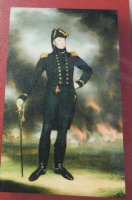
[Painting]
British Rear Admiral George Cockburn led the Upper Bay campaign of the War of 1812. Image courtesy Nation Maritime Museum, Greenwich, London
Topics and series. This historical marker is listed in this topic list: War of 1812. In addition, it is included in the Star Spangled Banner National Historic Trail series list. A significant historical date for this entry is May 3, 1813.
Location. 39° 32.317′ N, 76° 5.237′ W. Marker is in Havre de Grace, Maryland, in Harford County. Marker can be reached from Commerce Street. Marker is midway on the Havre de Grace Promenade. Touch for map. Marker is in this post office area: Havre de Grace MD 21078, United States of America. Touch for directions.
Other nearby markers. At least 8 other markers are within walking distance of this marker . The Bayou (within shouting distance of this marker); Luxury on the Bay (about 300 feet away, measured in a direct line); Lure of the Chesapeake (about 300 feet away); State of Readiness (about 300 feet away); Home Base (about 400 feet away); Attack at Frenchtown (about 400 feet away); Lower Susquehanna Heritage Greenway (about 400 feet away); Enjoy the Havre de Grace Promenade (about 400 feet away). Touch for a list and map of all markers in Havre de Grace.
Credits. This page was last revised on December 14, 2020. It was originally submitted on April 5, 2013, by Bill Pfingsten of Bel Air, Maryland. This page has been viewed 491 times since then and 12 times this year. Last updated on December 8, 2020, by Carl Gordon Moore Jr. of North East, Maryland. Photos: 1, 2, 3. submitted on April 5, 2013, by Bill Pfingsten of Bel Air, Maryland. • J. Makali Bruton was the editor who published this page.


