Near Chippawa in Niagara Region, Ontario — Central Canada (North America)
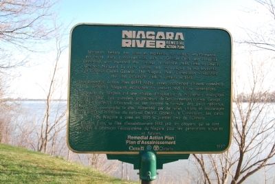
Niagara River Remedial Action Plan
The Remedial Action Plan (RAP) today unites concerned citizens committed to restoring Niagara's ecosystem for present and future generations.
La beauté du Niagara est un source d’inspiration du mouvement écologique d’aujourd’hui. Les premiers protecteurs de l’environment, comme George Catlin et Frederick Olmstead qui ont inventé la formule des parcs nationaux, sont venus contempler le site. Alimentée par de telles visions et encouragée par l’esprit d’initiative du colonel Casimir Gzowski, la Commission des parcs du Niagara a crée en 1885 le premier parc de l’Ontario.
De nos jours, le Plan d’assainissement (PA) unit les citoyens qui se sont engages a restaurer l’ecosystème du Niagara pour les generations actuelles et futures.
Erected 1997.
Topics. This historical marker is listed in this topic list: Environment. A significant historical year for this entry is 1885.
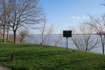
Location. 43° 3.337′ N, 79° 1.569′ W. Marker is near Chippawa, Ontario, in Niagara Region. Marker is at the intersection of Niagara Parkway and Service Road 30 on Niagara Parkway. Touch for map. Marker is in this post office area: Chippawa ON L2E 6S6, Canada. Touch for directions.
Other nearby markers. At least 8 other markers are within walking distance of this marker. The Destruction of The Caroline, 1837 (a few steps from this marker); Chippawa Battlefield Panel 6 (approx. 0.4 kilometers away); Chippawa Battlefield Panel 4 (approx. 0.4 kilometers away); Chippawa Battlefield Panel 5 (approx. 0.4 kilometers away); Chippawa Battlefield Panel 3 (approx. 0.4 kilometers away); Chippawa Battlefield Panel 1 (approx. 0.4 kilometers away); Chippawa Battlefield Panel 2 (approx. 0.4 kilometers away); The Battle of Chippawa (approx. 0.4 kilometers away). Touch for a list and map of all markers in Chippawa.
Credits. This page was last revised on September 27, 2019. It was originally submitted on April 21, 2013, by Mike Wintermantel of Pittsburgh, Pennsylvania. This page has been viewed 993 times since then and 4 times this year. Photos: 1, 2. submitted on April 21, 2013, by Mike Wintermantel of Pittsburgh, Pennsylvania.

