Harrisburg in Dauphin County, Pennsylvania — The American Northeast (Mid-Atlantic)
Camp Curtin
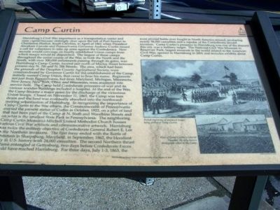
Harrisburg's Civil War importance as a transportation center and state capital became strikingly clear upon the fall of Fort Sumter in Charleston Harbor, South Carolina, in April of 1861 when President Abraham Lincoln and Pennsylvania Governor Andrew Curtin issued a call for volunteers to take up arms against the Confederacy. New recruits would converge on hastily established Union camps from which troops would be dispatched. The largest of these camps throughout the entire course of the War, in both the North and the South, with over 300,000 enlistments passing through its gates, was Harrisburg's Camp Curtin, located just north of Maclay Street between present-day N. 7th and N. 5th Streets. The area, which had been the grounds of the Dauphin County Agricultural Society, were commandeered by Governor Curtin for the establishment of the Camp, initially named Camp Union, that came to bear his name. Regiments not just from Pennsylvania, but from Maryland, Michigan, Minnesota, New Jersey, New York, Ohio and Wisconsin, were mustered into service here. The Camp held Confederate prisoners-of-war and its various wooden buildings included a hospital. At the end of the War, the Camp became a major point for the discharge of the victorious Union troops. Closed on November 11, 1865, the Camp was torn down and the land was eventually absorbed into the northward-moving urbanization of Harrisburg. In recognizing the importance of Camp Curtin to the War effort, the Commonwealth of Pennsylvania erected the present statue of Curtin in October 1922, on the plot of land that had been part of the Camp at N. Sixth and Woodbine Streets and on what is the smallest State Park in Pennsylvania. The neighboring Camp Curtin Memorial-Mitchell United Methodist Church houses various Civil War artifacts and commemorative artwork. Harrisburg was twice the military objective of Confederate General Robert E. Lee in the Northern invasions. The first foray ended with the Battle of Antietam in Sharpsburg, Maryland, in September, 1862, the bloodiest day in U.S. history with 24,000 casualties. The second Northern thrust became entangled at Gettysburg, two days before Confederate forces could have reached Harrisburg. For three days, July 1-3, 1863, the most pivotal battle ever fought in North America ensued, producing nearly 58,000 casualties and a repulse of the Confederate second invasion. Camp Curtin's presence in Harrisburg was one of the reasons this city was a military target. The National Civil War Museum in Reservoir Park, largest museum in the world related to the American Civil War, opened in Harrisburg in 2001 and includes exhibits about Camp Curtin.
[Captions:]
Period engraving of mustered troops being drilled at Camp Curtin.
View of Camp Curtin's General Hospital, the only-known photograph taken at the Camp.
Erected by The Harrisburg History Project Commissioned by Mayor Stephen R. Reed.
Topics and series. This historical marker is listed in this topic list: War, US Civil. In addition, it is included in the Pennsylvania, The Harrisburg History Project series list. A significant historical month for this entry is April 1861.
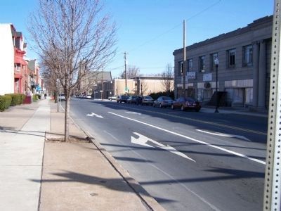
Location. 40° 16.833′ N, 76° 53.427′ W. Marker is in Harrisburg, Pennsylvania, in Dauphin County. Marker is at the intersection of Sixth Street and Maclay St., on the right when traveling south on Sixth Street. Touch for map. Marker is in this post office area: Harrisburg PA 17110, United States of America. Touch for directions.
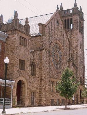
Other nearby markers. At least 8 other markers are within walking distance of this marker. A different marker also named Camp Curtin (about 700 feet away, measured in a direct line); a different marker also named Camp Curtin (about 700 feet away); Camp Curtin Memorial-Mitchell United Methodist Church (about 800 feet away); Reily Hose Company No. 10 (approx. 0.3 miles away); Cottage Ridge (approx. 0.3 miles away); Pennsylvania Farm Show (approx. 0.4 miles away); Simon Cameron School (approx. 0.4 miles away); Governor's Residence (approx. half a mile away). Touch for a list and map of all markers in Harrisburg.
Regarding Camp Curtin.
A sentence starts "The area, which had been the grounds of the Dauphin County Agricultural Society, were commandeered by ..." and should have used "was" (singular) instead of "were".
Related markers. Click here for a list of markers that are related to this marker. Related Camp Curtin markers.
Credits. This page was last revised on July 14, 2022. It was originally submitted on March 22, 2008, by Bill Pfingsten of Bel Air, Maryland. This page has been viewed 2,808 times since then and 37 times this year. Last updated on July 14, 2022, by Carl Gordon Moore Jr. of North East, Maryland. Photos: 1, 2. submitted on March 22, 2008, by Bill Pfingsten of Bel Air, Maryland. 3. submitted on August 12, 2014, by John K. Robinson of Harrisburg, Pennsylvania. • Devry Becker Jones was the editor who published this page.


