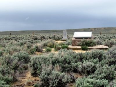
Near Farson in Sublette County, Wyoming — The American West (Mountains)
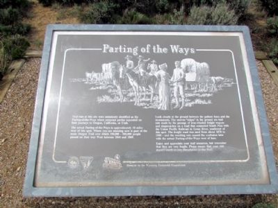
Parting of the Ways
Trail ruts at this site were mistakenly identified as the Parting-of-the-Ways where emigrant parties separated on their journeys to Oregon, California, or Utah.
The actual Parting-of-the-Ways is approximately 10 miles west of this spot. Where you are standing now is part of the main Oregon Trail over which 350,000 - 500,000 people passed on their way West between 1844 and 1869.
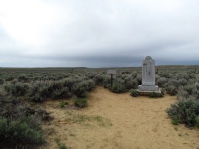
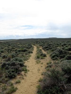
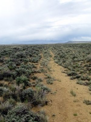
Look closely at the ground between the pullout fence and the monuments. The uneven "ridges" in the ground are trail ruts made by the passage of iron-wheeled freight wagons and stagecoaches on a road that connected South Pass with the Union Pacific Railroad in Green River, southwest of this spot. The freight road was used from about 1870 to 1900 - and the resulting ruts caused the confusion later with the actual Parting-of-the-Ways west of here.
Enjoy and appreciate your trail resources, but remember that they are very fragile. Please ensure that you visit doesn't result in any disturbance to the Trail.
Erected by Bureau of Land Management, U.S. Department of the Interior.
Topics and series. This historical marker is listed in these topic lists: Roads & Vehicles • Settlements & Settlers . In addition, it is included in the California Trail, the Mormon Pioneer Trail, and the Oregon Trail series lists. A significant historical year for this entry is 1844.
Location. 42° 17.089′ N, 109° 3.538′ W. Marker is near Farson, Wyoming, in Sublette County. Marker can be reached from State Highway 28, 7 miles north of Sqaw Road (Route BLM4106). Marker is accessible from scenic pull-out on State Route 28. Touch for map. Marker is in this post office area: Lander WY 82520, United States of America. Touch for directions.
Other nearby markers. At least 8 other markers are within 6 miles of this marker, measured as the crow flies. A different marker also named "Parting of the Ways" (within shouting distance of this marker); a different marker also named The Parting of the Ways (within shouting distance of this marker); The Oregon Trail (within shouting distance of this marker); Twin Mounds (approx. 5.4 miles away); The Way West (approx. 5.4 miles away); The Corridor West (approx. 5.4 miles away); The Fur Trade (approx. 5.4 miles away); South Pass (approx. 5.4 miles away). Touch for a list and map of all markers in Farson.
More about this marker. I am a bit confused; I visited this marker a few weeks ago. The current picture if this marker is not what I saw there; the one I saw is the picture from marker 96684. Maybe your information is valid and the marker picture are inverted, or the error is the location of the actual markers themselves. I read the note in this page about "Trail ruts at this site were mistakenly identified as the Parting-of-the-Ways where emigrant parties separated on their journeys to Oregon, California, or Utah." Maybe adding a clarification if the physical markers are inverted.
Credits. This page was last revised on March 3, 2024. It was originally submitted on July 26, 2013, by Duane Hall of Abilene, Texas. This page has been viewed 783 times since then and 44 times this year. Last updated on December 6, 2023, by Jean Lachance of Ile-Bizard, Quebec. Photos: 1, 2, 3, 4, 5. submitted on July 26, 2013, by Duane Hall of Abilene, Texas. • Devry Becker Jones was the editor who published this page.
