Havre de Grace in Harford County, Maryland — The American Northeast (Mid-Atlantic)
No Respect
Star-Spangled Banner National Historic Trail
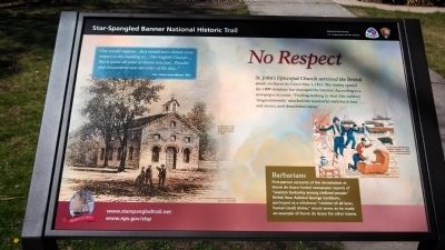
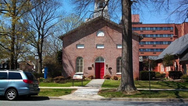
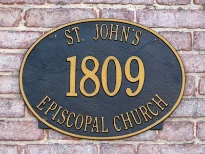
St. John's Episcopal Church survived the British attack on Havre de Grace May 3, 1813. The enemy spared the 1809 structure but damaged the interior. According to a newspaper account: "Finding nothing to steal (the raiders) 'magnanimously' attacked the windows(s) with brick bats and stones, and demolished them."
"One would suppose...they would have shown some respect to this building as...'The English Church'...But it seems all sense of shame was lost...Plunder and devastation was the order of the day..."
-Rev. James Jones Wilmer, 1813
Barbarians
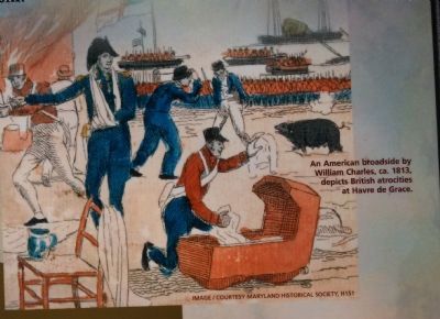
First-person accounts of the devastation at Havre de Grace fueled newspaper reports of "wanton barbarity among civilized people." British Rear Admiral George Cockburn, portrayed as a villainous "violator of all laws, human (and) divine," struck terror as he made an example of Havre de Grace for other towns.
[caption of drawing at right]
An American broadside by William Charles, ca. 1813, depicts British atrocities at Havre de Grace.
8mage / courtesy Maryland Historical Society, H151
[caption of drawing at lower left]
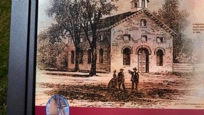
A depiction of the church before the belfry was added in 1884
image / pictorial field-book of the War of 1812,
Benson J. Lossing (1868)
Erected 2013.
Topics and series. This historical marker is listed in this topic list: War of 1812. In addition, it is included in the Star Spangled Banner National Historic Trail series list. A significant historical date for this entry is May 3, 1813.
Location. 39° 32.875′ N, 76° 5.507′ W. Marker is in Havre de Grace, Maryland, in Harford County. Marker is at the intersection of Union Avenue and Congress Street, on the right when traveling south on Union Avenue. Touch for map. Marker is in this post office area: Havre de Grace MD 21078, United States of America. Touch for directions.
Other nearby markers. At least 8 other markers are within walking distance of this marker. "The People of Havre de Grace" (about 400 feet away, measured in a direct line); War in the Chesapeake (about 400 feet away); Surprise Attack (about 400 feet away); "O! say can you see…" (about 400 feet away); Out of the Flames (approx. 0.2 miles away); Rochambeau Plaza (approx. 0.2 miles away); Dedicated in Honor (approx. 0.2 miles away); 'We used to have a race track' (approx. 0.2 miles away). Touch for a list and map of all markers in Havre de Grace.
Credits. This page was last revised on December 3, 2020. It was originally submitted on April 14, 2013, by Bill Pfingsten of Bel Air, Maryland. This page has been viewed 653 times since then and 18 times this year. Last updated on December 2, 2020, by Carl Gordon Moore Jr. of North East, Maryland. Photos: 1, 2, 3, 4. submitted on April 14, 2013, by Bill Pfingsten of Bel Air, Maryland. 5, 6. submitted on October 10, 2013, by Allen C. Browne of Silver Spring, Maryland.
