Near Santa Nella in Merced County, California — The American West (Pacific Coastal)
Pacheco Pass
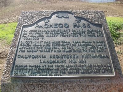
On June 18, 1805, Lieutenant Gabriel Moraga, on his first exploratory journey into the San Joaquin Valley traversed this pass and recorded it.
Since then it has been trail, toll road, stagecoach road, and freeway -- the principal route between the coastal areas to the west and the great valley and mountains to the east.
California Registered Historical Landmark No. 829
Plaque placed by the State Department of Parks and Recreation in cooperation with the Merced County Historical Advisory Committee and the Native Daughters of the Golden West, June 18, 1969.
Erected 1969 by California State Department of Parks and Recreation, Merced County Historical Advisory Committee, Native Daughters of the Golden West. (Marker Number 829.)
Topics and series. This historical marker is listed in these topic lists: Hispanic Americans • Native Americans • Roads & Vehicles. In addition, it is included in the California Historical Landmarks, and the Native Sons/Daughters of the Golden West series lists. A significant historical date for this entry is June 18, 1805.
Location. 37° 4.825′ N, 121° 5.892′ W. Marker is near Santa Nella, California, in Merced County. Marker can be reached from State Highway 152, 6 miles west of Interstate 5. Touch for map. Marker is in this post office area: Gustine CA 95322, United States of America. Touch for directions.
Other nearby markers. At least 8 other markers are within 3 miles of this marker, measured as the crow flies. Remember Pearl Harbor (approx. 2˝ miles away); The Remembrance Memorial for California Korean War Veterans (approx. 2.6 miles away); In Memory of Korean War Veterans (approx. 2.6 miles away); The Chosin Few (approx. 2.6 miles away); First Marine Division – FMF (approx. 2.6 miles away); a different marker also named In Memory of Korean War Veterans (approx. 2.6 miles away); San Joaquin Valley National Cemetery (approx. 2.6 miles away); United States Submariners Memorial (approx. 2.7 miles away). Touch for a list and map of all markers in Santa Nella.
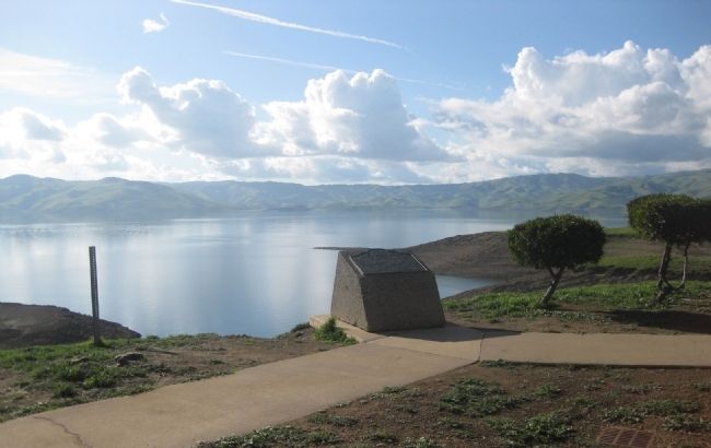
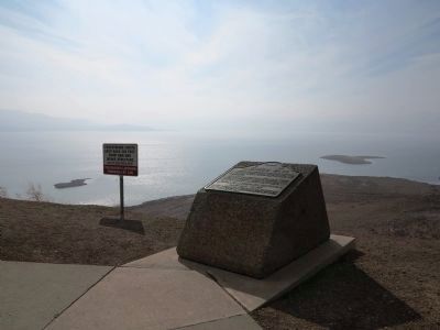
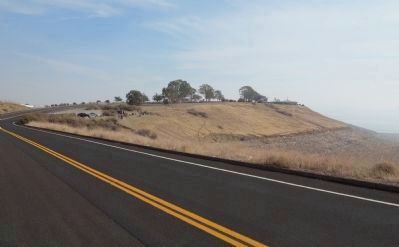
More about this marker. To find the marker, take the signed road off of Highway 152 to the Romero Visitor Center, which is situated on a promontory overlooking San Luis Reservoir. The marker is mounted on a low cement monument on the west side of the Visitor Center.
Also see . . .
1. Pacheo Pass. Wikipedia entry (Submitted on February 12, 2021, by Larry Gertner of New York, New York.)
2. San Luis Reservoir SRA. California Department of Parks and Recreation entry:
The description of the San Luis Reservoir State Recreation Area includes a brief history of the Pacheco Pass, "Pacheco
Pass was named for Don Juan Pacheco, who settled here in the 1840s. The pass was used by Native Americans, Spanish soldiers and missionaries, Mexican ranchers, and gold miners, as well as more recent travelers. In 1856, Andrew Firebaugh improved the pass and made it a toll road, with a toll house two miles west of the summit. He had hardly finished when the Butterfield-Overland stages began using the road as part of their route from San Francisco to Missouri...." (Submitted on February 7, 2010.)
Credits. This page was last revised on August 4, 2023. It was originally submitted on February 7, 2010, by Andrew Ruppenstein of Lamorinda, California. This page has been viewed 3,046 times since then and 109 times this year. Last updated on July 28, 2023, by Ronald D. (Ron) Trigueiro of Fresno, California. Photos: 1, 2. submitted on February 7, 2010, by Andrew Ruppenstein of Lamorinda, California. 3, 4, 5. submitted on November 29, 2013, by Richard Denney of Austin, Texas. 6. submitted on February 12, 2021, by Larry Gertner of New York, New York. • Bill Pfingsten was the editor who published this page.
