Atlas District in Northeast Washington in Washington, District of Columbia — The American Northeast (Mid-Atlantic)
Sanctuaries
Hub, Home, Heart
— Greater H Street NE Heritage Trail —
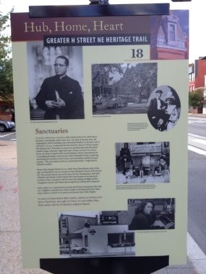
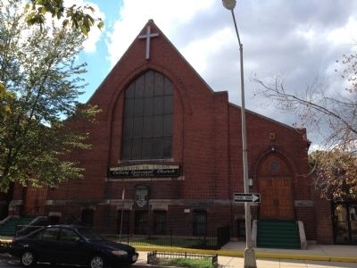
Calvary Episcopal Church, half a block north at 820 Sixth Street, has been a community anchor since 1901. For most of its early years, the congregation, led by founding rector Reverend Franklin I.A. Bennett, met at 11th and G. In 1941 it welcomed the Reverend Dr. James O. West as rector. The dynamic Rev. West drew so many new members that soon the parish needed a larger sanctuary. Eight years later Calvary moved to its current home, the former Church of the Good Shepherd. West is remembered for co-founding the family social services center Hospitality House, sheltering and feeding the homeless in his rectory, and counseling troubled Vietnam veterans. "The city looked to him as a community leader," Judge Kaye K. Christian recalled.
Mount Olive Baptist Church at 1140 Sixth Street, three blocks north of this sign, was founded in 1873 as a branch of Second Baptist Church of Northwest DC. The current church rests on the site of its first meeting place, the home of Robert and Martha Terrell. Mount Olive has focused on serving needy members of the community with free food and clothing, holding outdoor evangelistic services, and mentoring teenaged boys, among other programs.
Radio station WOL operated from Fourth and H Streets during the 1980s and '90s. Neighbors remember the station's studio overlooking the street, where large windows revealed on-air guests and dynamic host Cathy Hughes.
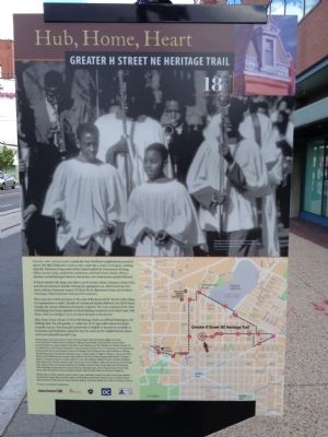
To return to Union Station Metro station, continue on H Street, turn left on Third Street, then right on F Street. To reach Gallery Place Metro station, take the X2 Metrobus (Lafayette Square).
Erected 2012 by Cultural Tourism DC. (Marker Number 18.)
Topics and series. This historical marker is listed in this topic list: Churches & Religion. In addition, it is included in the Greater H Street Heritage Trail series list. A significant historical year for this entry is 1901.
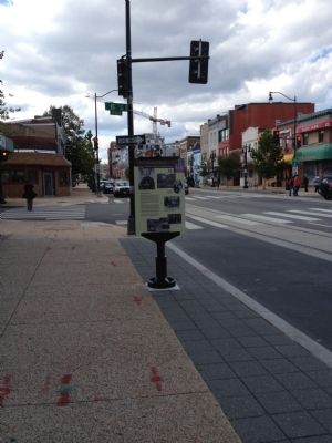
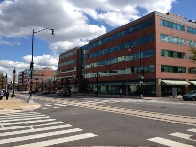
Location. 38° 54.01′ N, 76° 59.897′ W. Marker is in Northeast Washington in Washington, District of Columbia. It is in the Atlas District. Marker is at the intersection of H Street Northeast and 6th Street Northeast, on the right when traveling east on H Street Northeast. Touch for map. Marker is at or near this postal address: 601 H Street Northeast, Washington DC 20002, United States of America. Touch for directions.
Other nearby markers. At least 8 other markers are within walking distance of this marker. Get Behind the Wheel (about 400 feet away, measured in a direct line); The Fires of 1968 (about 700 feet away); Cathy Hughes (about 700 feet away); At the Crossroads (approx. 0.2 miles away); Community Caretakers (approx. 0.2 miles away); Greater Pleasant Grove Baptist Church (approx. 0.3 miles away); Roll Out the Barrel (approx. 0.3 miles away); Life on H Street (approx. 0.3 miles away). Touch for a list and map of all markers in Northeast Washington.
Credits. This page was last revised on January 30, 2023. It was originally submitted on October 7, 2012, by Craig Swain of Leesburg, Virginia. This page has been viewed 437 times since then and 23 times this year. Last updated on July 7, 2020, by Bruce Guthrie of Silver Spring, Maryland. Photos: 1, 2, 3, 4, 5. submitted on October 7, 2012, by Craig Swain of Leesburg, Virginia. • Devry Becker Jones was the editor who published this page.
