Huntington in Cabell County, West Virginia — The American South (Appalachia)
Battle of Guyandotte
Federal Retaliation
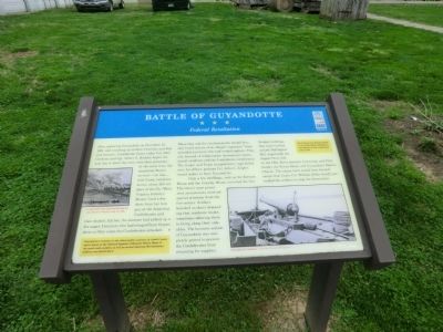
After capturing Guyandotte on November 10, 1861, and rounding up civilian Unionists and Federal recruits, Confederate forces under Col. John Clarkson and Col. Albert G. Jenkins began the next day to leave the town with their prisoners. At the same time the steamboat Boston arrived—too late—with Union reinforcements, about 200 soldiers of the 5th (West) Virginia Infantry. Boston fired a few shots from her bow gun at the departing Confederates and then docked. Earlier, the steamer had picked up a few angry Unionists who had escaped from Guyandotte to Ohio when the Confederates attacked.
When they and the reinforcements landed here, they heard stories of an alleged “massacre” from wounded survivors who had evaded capture. They also learned of collaboration between pro-secessionist residents and the Confederate cavalrymen. The troops’ and Union sympathizers’ rage boiled over. An officer, perhaps Col. John L. Ziegler, issued orders to burn Guyandotte.
Only a few dwellings, such as the Keenan House and the Crawley House, survived the fire. The town’s most prominent secessionists received special attention from the fire-setters. Soldiers knocked on doors demanding that residents vacate, sometimes allowing them to bring along their valuables. The business section of Guyandotte was completely gutted to prevent the Confederates from returning for supplies.
Notable buildings that were torched include Buffington Mill (reportedly the largest flour mill on the Ohio River between Cincinnati and Pittsburgh), the Forest Hotel, and Guyandotte Baptist Church. The entire town would have been burned, except that Union Col. William Bolles finally persuaded the soldiers to stop the destruction.
[Sidebars:]
Guyandotte’s cemetery is the oldest public cemetery in Cabell County and is listed on the National Register of Historic Places. Many of the area’s early settlers, as well as several American Revolutionary soldiers, are buried there.
The Federal style Keenan House is one the oldest buildings in Guyandotte. It was constructed before 1840.
Erected by West Virginia Civil War Trails.
Topics and series. This historical marker is listed in this topic list: War, US Civil. In addition, it is included in the West Virginia Civil War Trails series list. A significant historical date for this entry is November 10, 1861.
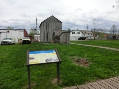
Location. 38° 25.723′ N, 82° 23.399′ W. Marker is in Huntington, West Virginia, in Cabell County. Marker can be reached from Guyan Street north of 5th Avenue, on the left when traveling south. The marker is located in the backyard of the Madie Carroll House. Touch for map. Marker is at or near this postal address: 234 Guyan Street, Huntington WV 25702, United States of America. Touch for directions.
Other nearby markers. At least 8 other markers are within walking distance of this marker. A different marker also named Battle of Guyandotte (here, next to this marker); Madie Carroll House (a few steps from this marker); Historic Carroll House (within shouting distance of this marker); Granville Parker (within shouting distance of this marker); Raid on Guyandotte / Burning of Guyandotte (about 300 feet away, measured in a direct line); First Cabell County Court House (about 500 feet away); John S. Witcher (about 700 feet away); Guyandotte (about 800 feet away). Touch for a list and map of all markers in Huntington.
Credits. This page was last revised on December 26, 2023. It was originally submitted on May 14, 2014, by Don Morfe of Baltimore, Maryland. This page has been viewed 922 times since then and 36 times this year. Last updated on December 25, 2023, by Carl Gordon Moore Jr. of North East, Maryland. Photos: 1, 2, 3, 4. submitted on May 14, 2014, by Don Morfe of Baltimore, Maryland. • Devry Becker Jones was the editor who published this page.


