Chama in Rio Arriba County, New Mexico — The American Mountains (Southwest)
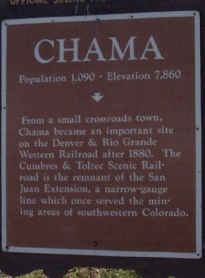
Chama
Population 1,090 - Elevation 7,860 ft.
Topics. This historical marker is listed in this topic list: Railroads & Streetcars. A significant historical year for this entry is 1880.
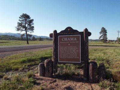
Location. 36° 51.522′ N, 106° 34.658′ W. Marker is in Chama, New Mexico, in Rio Arriba County. Marker is on Highway 84/64 (State Road 84). Touch for map. Marker is in this post office area: Chama NM 87520, United States of America. Touch for directions.
Other nearby markers. At least 8 other markers are within 14 miles of this marker, measured as the crow flies. Old Spanish Trail (approx. 1.8 miles away); a different marker also named Chama (approx. 3.1 miles away); 1881 Log Bunkhouse (approx. 3.2 miles away); Continental Divide (approx. 8.8 miles away); Fort Lowell (approx. 9.6 miles away); Tierra Amarilla (approx. 10.2 miles away); Cumbres Pass (approx. 10.3 miles away); a different marker also named Cumbres Pass (approx. 13.2 miles away in Colorado). Touch for a list and map of all markers in Chama.
Also see . . . The Cumbres & Toltec Scenic Railroad. The Cumbres & Toltec Scenic Railroad is another famous narrow-gauge tourist railroad in southwest Colorado and northwest New Mexico. (Submitted on June 9, 2014.)
Credits. This page was last revised on June 16, 2016. It was originally submitted on June 9, 2014, by Maribeth Robison of Moriarty, New Mexico. This page has been viewed 541 times since then and 20 times this year. Photos: 1, 2. submitted on June 9, 2014, by Maribeth Robison of Moriarty, New Mexico. • Syd Whittle was the editor who published this page.

