Celina in Clay County, Tennessee — The American South (East South Central)
Butler's Landing / Bailey Butler
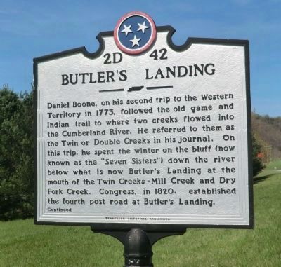
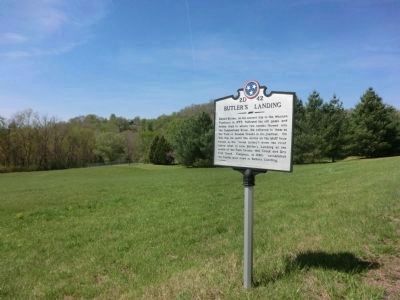
Daniel Boone, on his trip to the Western Territory in 1773, followed the old game and Indian trail to where two creeks flowed into the Cumberland River. He referred to them as the Twin or Double Creeks in his journal. On this trip, he spent the winter on the bluff (now known as the "Seven Sisters") down the river below what is now Butler's Landing at the mouth of the Twin Creeks-Mill Creek and Dry Fork Creek. Congress, in 1820, established the fourth post road at Butler's Landing.
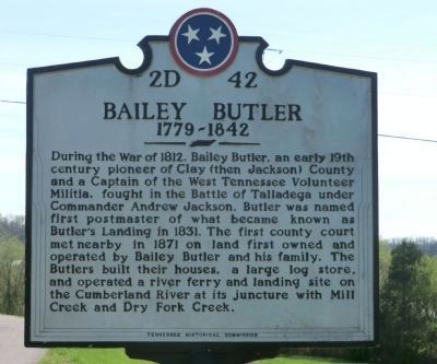
-During the War of 1812, Bailey Butler, an early 19th century pioneer of Clay (then Jackson) County and a Captain of the West Tennessee Volunteer Militia, fought in the Battle of Talladega under Commander Andrew Jackson. Butler was named first postmaster of what became known as Butler's Landing in 1831. The first county court met nearby in 1871 on land first owned and operated by Bailey Butler and his family. The Butlers built their houses, a large log store, and operated a river ferry and landing site on the Cumberland River at is juncture with Mill Creek and Dry Fork Creek.
Erected by Tennessee Historical Commission. (Marker Number 2D 42.)
Topics and series. This memorial is listed in these topic lists: Roads & Vehicles • Settlements & Settlers • War of 1812. In addition, it is included in the Tennessee Historical Commission series list. A significant historical year for this entry is 1773.
Location. 36° 29.586′ N, 85° 33.684′ W. Marker is in Celina, Tennessee, in Clay County. Memorial is on Gainsboro Highway (SR 53). Touch for map. Marker is in this post office area: Celina TN 38551, United States of America. Touch for directions.
Other nearby markers. At least 8 other markers are within 5 miles of this marker, measured as the crow flies. Hugh Roberts (approx. 4.8 miles away); History of the Webb Cemetery (approx. 4.8 miles away); Donaldson Cemetery (approx. 4.8 miles away); William Hull Building (approx. 5 miles away); The Clay County Courthouse (approx. 5 miles away); Clay County Veterans Memorial (approx. 5 miles away); Clay County Veterans Monument (approx. 5 miles away); Celina During the Civil War (approx. 5 miles away). Touch for a list and map of all markers in Celina.
Additional commentary.
1. Bailey Butler historical marker
Baily Butler is my great-great-great-grandfather. The Tennessee Historical Commission approved the historical marker and the sponsors were William J. Butler, Esq, of Lake Forest, IL; Emily Butler of Chicago, IL; Robert C. Butler of Suffern NY; Mary Butler Hastings of Honolulu, HI; and Carolyn Butler Douglas of San Diego, CA, all of whom are descendants of Bailey Butler. There was a Butler family reunion on July 4, 2003 at Butler's Landing Church of Christ to dedicate the marker.
Bailey Butler is buried at the Bailey Butler Cemetery at Turkey Creek Bottom on the old Butler farm, across the Cumberland River west from Butlers Landing about 300 yards northwest from the old ferry.
— Submitted July 9, 2020, by Sandy Bauer of Sun City West, Arizona.
Credits. This page was last revised on July 11, 2020. It was originally submitted on June 10, 2014, by Don Morfe of Baltimore, Maryland. This page has been viewed 1,846 times since then and 136 times this year. Last updated on June 11, 2014, by Keith S Smith of West Chester, Pennsylvania. Photos: 1, 2, 3. submitted on June 10, 2014, by Don Morfe of Baltimore, Maryland. • Bill Pfingsten was the editor who published this page.


