Near Burlington in Alamance County, North Carolina — The American South (South Atlantic)
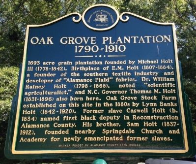
Oak Grove Plantation
1790-1910
Erected 2014 by Alamance County Historical Museum.
Topics. This historical marker is listed in these topic lists: African Americans • Agriculture • Industry & Commerce • Settlements & Settlers. A significant historical year for this entry is 1693.
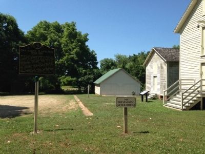
Location. 36° 1.154′ N, 79° 29.424′ W. Marker is near Burlington, North Carolina, in Alamance County. Marker can be reached from the intersection of North Carolina Route 62 and Kimesville Road (County Route 1113), on the right when traveling west. Marker is located in the parking lot of the Alamance County Historical Museum. Touch for map. Marker is at or near this postal address: 4777 NC-62, Burlington NC 27215, United States of America. Touch for directions.
Other nearby markers. At least 8 other markers are within 2 miles of this marker, measured as the crow flies. A different marker also named Oak Grove Plantation (here, next to this marker); St. Paul's Lutheran Church (approx. 0.7 miles away); Trading Path (approx. 1.2 miles away); Battle of Clapp's Mill (approx. 1.3 miles away); Alamance Mill Village (approx. 1.4 miles away); Alamance Cotton Mill (approx. 1.4 miles away); Johnston Moves West (approx. 1.4 miles away); Tryon’s Camp (approx. 1.4 miles away). Touch for a list and map of all markers in Burlington.
Also see . . . Alamance County Historical Museum. (Submitted on June 16, 2014.)
Credits. This page was last revised on May 9, 2023. It was originally submitted on June 15, 2014, by Patrick G. Jordan of Graham, North Carolina. This page has been viewed 1,707 times since then and 136 times this year. Last updated on May 9, 2023, by Michael Buckner of Durham, North Carolina. Photos: 1, 2. submitted on June 15, 2014, by Patrick G. Jordan of Graham, North Carolina. • Bernard Fisher was the editor who published this page.

