Pokagon State Park near Angola in Steuben County, Indiana — The American Midwest (Great Lakes)
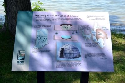
Beginning in Ice: The Lakes of Pokagon
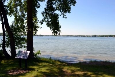
You are looking at the lower basin of Lake James. The lake is the third largest natural lake in Indiana (1,140 acres). With the middle and upper basins of Lake James, and Snow Lake, the park has water on three sides.
The 120 lakes of Steuben County formed at the end of the most recent glaciation, the Wisconsin.
At that time, the Saginaw ice lobe ceased its southern advance, and began to melt and break apart.
Among the features formed were kettle holes. These formed when large blocks of ice broke free and were buried under tons of glacial debris. The debris insulated the ice block. The ice blocks slowly melted leaving behind a water-filled depression. Lake James is a large kettle lake.
Kettle lakes are uneven in depth and even small lakes can be quite deep. Lake James reaches a maximum depth of 88 feet.
The People
Humans arrived shortly after the glacier receded. The lakes, wetlands and forests were abundant in wildlife and fish. The Potwatomi tribe settled on the shores of Lake James during the early 1800s. Potawatomi people still live throughout the country, many settling along the Indiana-Michigan border.
Between the Great Lakes and the Ohio there is no more beautiful tract of country than this country.
Charles R. Dyer, Surveyor
1891 Geological Report of Steuben County
The time may come when the lakes of Steuben County will be the most valuable and profitable possession of her citizens, who will then seek and devise means for preserving instead of destroying them.
Charles R. Dyer
Erected by Indiana Department of Natural Resources.
Topics. This historical marker is listed in these topic lists: Environment • Native Americans. A significant historical year for this entry is 1891.
Location. 41° 42.161′ N, 85° 1.391′ W. Marker is near Angola, Indiana, in Steuben County. It is in Pokagon State Park. Marker can be reached from State Road 727, 0.8 miles west of Interstate 69. Marker is located in Pokagon State Park west of the Potawatomi Inn swimming beach; the above directions are to the park entrance. Touch for map. Marker is in this post office area: Angola IN 46703, United States of America. Touch for directions.
Other nearby markers. At least 8 other markers are within walking distance of this marker. Welcome to the Potawatomi Inn (about 600 feet away, measured in a direct line); Latrine (approx. 0.3 miles away); Bath House (approx. 0.3 miles away); Pokagon's Toboggan Slide (approx. 0.3 miles away); Barracks #1 (approx. 0.3 miles away); Dryer Hill (approx. 0.3 miles away); Recreation Hall
(approx. 0.3 miles away); Mess Hall (approx. 0.4 miles away). Touch for a list and map of all markers in Angola.
Credits. This page was last revised on December 29, 2023. It was originally submitted on June 23, 2014, by Duane Hall of Abilene, Texas. This page has been viewed 682 times since then and 24 times this year. Last updated on November 15, 2023, by Lou Donkle of Valparaiso, Indiana. Photos: 1, 2, 3, 4. submitted on June 23, 2014, by Duane Hall of Abilene, Texas. • Devry Becker Jones was the editor who published this page.


