Brandywine in Prince George's County, Maryland — The American Northeast (Mid-Atlantic)
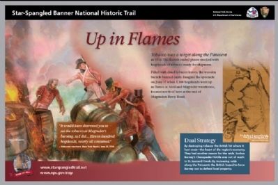
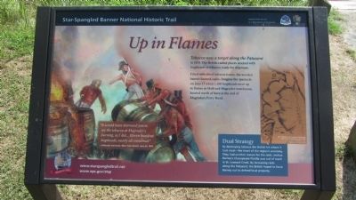
Up in Flames
Star-Spangled Banner National Historic Trail
Dual Strategy
By destroying tobacco the British hit where it hurt most—the heart of the region’s economy. They had another reason for the raids. Joshua Barney’s Chesapeake Flotilla was out of reach in St. Leonard Creek. By increasing raids along the Patuxent, the British hoped to force Barney out to defend local property.
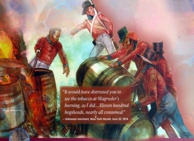
“It would have distressed you to see the tobacco at Magruder’s burning, as I did... Eleven hundred hogsheads, nearly all consumed.”
– Unknown merchant, New York Herald, June 25, 1814
IMAGE / © GERRY EMBLETON
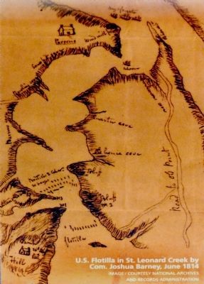
U.S. Flotilla in St. Leonard Creek by Com. Joshua Barney, June 1814 IMAGE / COURTESY NATIONAL ARCHIVES AND RECORDS ADMINISTRATION"
Erected by National Park Service.
Topics and series. This historical marker is listed in this topic list: War of 1812. In addition, it is included in the Star Spangled Banner National Historic Trail series list. A significant historical month for this entry is June 1861.
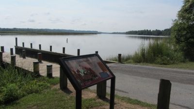
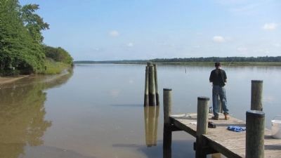
Location. 38° 38.399′ N, 76° 41.655′ W. Marker is in Brandywine, Maryland, in Prince George's County. Marker can be reached from Magruder's Ferry Road, 1.1 miles east of Croom Road (Maryland Route 382). Just before the gate on Macgruder Ferry Road, enter the Clyde Watson Boating Area and follow road about 1000 feet to the pier. Touch for map. Marker is at or near this postal address: 17901 Magruder's Ferry Road, Brandywine MD 20613, United States of America. Touch for directions.
Other nearby markers. At least 8 other markers are within 5 miles of this marker, measured as the crow flies. Town Ravaged (approx. 1.3 miles away); Lower Marlboro Town (approx. 1.3 miles away); Warships and Raids (approx. 1.4 miles away); Woodville School (approx. 3˝ miles away); Brig Gen Leonard Covington (approx. 4.1 miles away); Alarming Sight (approx. 4.2 miles away); Immanuel Church (approx. 4.3 miles away); St. Paul's Episcopal Church (approx. 4.4 miles away).
Additional commentary.
1. Battle of Maguder's Ferry
"In reference to the warehouse at Magruder's Ferry, it appears that a considerable American force was stationed behind it. Being filled with tobacco, it afforded complete protection against the cannon of the enemy; and a battle was fought with the British vessels, which continued until the ammunition of our troops was exhausted, and they were consequently obliged to retreat. Upon the retreat of the American force, the British landed and burned the warehouse, with the tobacco of the petitioner R. Johnson, and others therein contained" – Senator James A. Bayard, Jr. In the Senate Feb. 17 1854.
— Submitted July 16, 2014, by Allen C. Browne of Silver Spring, Maryland.
Additional keywords. Star Spangled Banner National Historic Trail
Photographed By Allen C. Browne, July 13, 2014
6. Dual Strategy
By destroying tobacco the British hit where it hurt most—the heart of the region’s economy. They had another reason for the raids. Joshua Barney’s Chesapeake Flotilla was out of reach in St. Leonard Creek. By increasing raids along the Patuxent, the British hoped to force Barney out to defend local property.
U.S. Flotilla in St. Leonard Creek by Com. Joshua Barney, June 1814Close-up of map on marker
U.S. Flotilla in St. Leonard Creek by Com. Joshua Barney, June 1814
Credits. This page was last revised on June 16, 2016. It was originally submitted on November 26, 2012, by Anacostia Trails Heritage Area of Hyattsville, Maryland. This page has been viewed 947 times since then and 25 times this year. Last updated on July 16, 2014, by Allen C. Browne of Silver Spring, Maryland. Photos: 1. submitted on November 26, 2012, by Anacostia Trails Heritage Area of Hyattsville, Maryland. 2, 3, 4. submitted on August 24, 2013, by F. Robby of Baltimore, Maryland. 5, 6. submitted on July 16, 2014, by Allen C. Browne of Silver Spring, Maryland. • Bill Pfingsten was the editor who published this page.
