Lexington in Davidson County, North Carolina — The American South (South Atlantic)
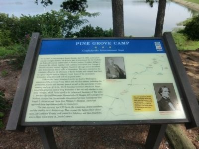
Pine Grove Camp
Confederate Government Seat
Unknown to Davis, Abraham Lincoln lay dead in Washington, assassinated the previous Friday. Davis met with his cabinet, including the postmaster general and attorney general as well as the secretaries of state, treasury, and war. At 10 p.m., North Carolina Governor Zebulon B. Vance joined the group for an hour-long discussion of the war and whether to continue the fight, which Davis hoped to do. Afterward, Secretary of War John C. Breckinridge and Postmaster General John H. Reagan left Lexington for Durham to supervise the surrender discussions between Confederate Gen. Joseph E. Johnston and Union Gen. William T. Sherman. Davis had approved these negotiations while in Greensboro.
The next morning, April 17, Davis, the remaining cabinet members and the cavalry escort broke camp. They crossed the Yadkin River about noon, left Davidson County, and headed for Salisbury and then Charlotte, where Davis would learn of Lincoln’s death.
(sidebar)
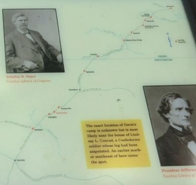
The exact location of Davis’s camp is unknown but is most likely near the house of Lindsay L. Conrad, a Confederate soldier whose leg had been amputated. An earlier marker southeast of here notes the spot.
(captions)
(upper right) Zebulon B. Vance Courtesy Library of Congress
(lower right) President Jefferson Davis Courtesy Library of Congress
Erected by North Carolina Civil War Trails.
Topics and series. This historical marker is listed in this topic list: War, US Civil. In addition, it is included in the North Carolina Civil War Trails series list. A significant historical date for this entry is April 16, 1871.
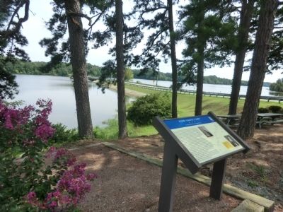
Location. Marker has been reported missing. It was located near 35° 53.33′ N, 80° 11.458′ W. Marker was in Lexington, North Carolina, in Davidson County. Marker could be reached from Yokley Road, 0.6 miles east of Ridge Road, on the left when traveling east. The marker is located in Tom-A-Lex Park. Touch for map. Marker was at or near this postal address: 700 Yokley Rd, Lexington NC 27295, United States of America. Touch for directions.
Other nearby markers. At least 8 other markers are within 6 miles of this location, measured as the crow flies. Pilgrim Church (approx. 2.7 miles away); First Site of Pilgrim Reformed Church (approx. 2.8 miles away); Pilgrim Cemetery Revolutionary War Memorial (approx. 2.9 miles away); John H. Mills (approx. 3 miles away); North Carolina Vietnam Veterans Memorial (approx. 4.6 miles away); Mitchell House (approx. 5½ miles away); St. Stephen United Methodist Church (approx. 5.6 miles away); First Reformed Church (approx. 5.7 miles away). Touch for a list and map of all markers in Lexington.
Credits. This page was last revised on May 9, 2023. It was originally submitted on October 4, 2014, by Don Morfe of Baltimore, Maryland. This page has been viewed 1,170 times since then and 24 times this year. Last updated on May 8, 2023, by Michael Buckner of Durham, North Carolina. Photos: 1, 2, 3, 4. submitted on October 4, 2014, by Don Morfe of Baltimore, Maryland. • Bernard Fisher was the editor who published this page.


