Clayton in Johnston County, North Carolina — The American South (South Atlantic)
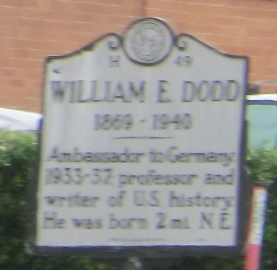
William E. Dodd
1869-1940
Erected 1949 by Division of Archives and History. (Marker Number H-49.)
Topics and series. This historical marker is listed in these topic lists: Education • Government & Politics. In addition, it is included in the North Carolina Division of Archives and History series list.
Location. 35° 39.023′ N, 78° 28.16′ W. Marker is in Clayton, North Carolina, in Johnston County. Marker is at the intersection of U.S. 70 Business (Business U.S. 70) and South Robertson Street (County Route 1552), on the right when traveling north on U.S. 70 Business. Touch for map. Marker is at or near this postal address: 11306 US-70 BUS, Clayton NC 27520, United States of America. Touch for directions.
Other nearby markers. At least 8 other markers are within 11 miles of this marker, measured as the crow flies. Flag of Truce (approx. half a mile away); Stone's Mills (approx. 7.7 miles away); Garner Historic District (approx. 8.6 miles away); Tenant House (approx. 10.1 miles away); The Pecan Grove (approx. 10.1 miles away); Carriage House (approx. 10.1 miles away); Farm House (approx. 10.1 miles away); Livestock Barn (approx. 10.1 miles away).
Credits. This page was last revised on March 4, 2023. It was originally submitted on October 10, 2014, by Don Morfe of Baltimore, Maryland. This page has been viewed 534 times since then and 33 times this year. Last updated on March 3, 2023, by Michael Buckner of Durham, North Carolina. Photo 1. submitted on October 10, 2014, by Don Morfe of Baltimore, Maryland. • J. Makali Bruton was the editor who published this page.
Editor’s want-list for this marker. In focus photo of marker and wide shot of marker and its surroundings. • Can you help?
