Near Charloe in Paulding County, Ohio — The American Midwest (Great Lakes)
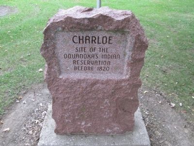
Charloe
Oquanoxa’s Village
— On the Auglaize River —
Topics. This historical marker is listed in these topic lists: Native Americans • Settlements & Settlers. A significant historical year for this entry is 1820.
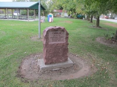
Location. 41° 7.894′ N, 84° 26.057′ W. Marker is near Charloe, Ohio, in Paulding County. Marker is at the intersection of County Road 171 and Charloe Trail (County Road 138), on the left when traveling north on County Road 171. The marker is located in Charloe Community Park along the west bank of the Auglaize River. Touch for map. Marker is at or near this postal address: 10899 Rd 171, Paulding OH 45879, United States of America. Touch for directions.
Other nearby markers. At least 8 other markers are within 8 miles of this marker, measured as the crow flies. Imaginary Likeness Of Chief Charloe Peter (a few steps from this marker); Charloe Community Park (a few steps from this marker); Site of Fort Brown (approx. 1.7 miles away); Fort Brown (approx. 1.7 miles away); The Indians (approx. 1.7 miles away); Miami-Erie and Wabash-Erie Canals (approx. 4½ miles away); Joshua A. Ramsey Memorial (approx. 5.3 miles away); Location of The Village of Milburn (approx. 7.2 miles away). Touch for a list and map of all markers in Charloe.
Additional keywords. Oquanoxa Okonoksee Ottawa Indians
Credits. This page was last revised on December 1, 2020. It was originally submitted on December 6, 2014, by Rev. Ronald Irick of West Liberty, Ohio. This page has been viewed 955 times since then and 56 times this year. Last updated on December 1, 2020, by Craig Doda of Napoleon, Ohio. Photos: 1, 2. submitted on December 6, 2014, by Rev. Ronald Irick of West Liberty, Ohio. • Devry Becker Jones was the editor who published this page.

