Niagara Falls in Niagara Region, Ontario — Central Canada (North America)
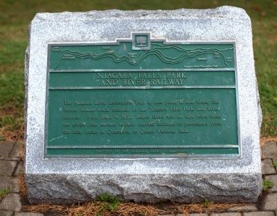
Niagara Falls Park and River Railway
Erected by the Niagara Parks Commission.
Topics. This historical marker is listed in this topic list: Railroads & Streetcars. A significant historical year for this entry is 1892.
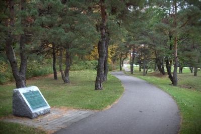
Location. 43° 7.338′ N, 79° 4.648′ W. Marker is in Niagara Falls, Ontario, in Niagara Region. Marker is on Niagara Parkway just south of Whirpool Road, on the right when traveling north. Touch for map. Marker is in this post office area: Niagara Falls ON L2E 6V5, Canada. Touch for directions.
Other nearby markers. At least 8 other markers are within walking distance of this marker. Buried Railway Trestle and Buried Gorge (about 180 meters away, measured in a direct line); Niagara River Recreation Trail (about 180 meters away); Thompson Point (approx. 0.7 kilometers away); Whirlpool Rapids Gorge (approx. 0.7 kilometers away); Niagara Spanish Aero Car (approx. 0.8 kilometers away); Eddy Basin (approx. one kilometer away in the U.S.); Challenging the Whirlpool Rapids (approx. 1.1 kilometers away in the U.S.); Niagara Gorge Natural History (approx. 1.1 kilometers away in the U.S.). Touch for a list and map of all markers in Niagara Falls.
Related markers. Click here for a list of markers that are related to this marker.
Also see . . . Great Gorge Route and the Niagara Falls Park and River Railway. Rick Berketa’s excellent compilation, with photographs, on the electric railways on both sides of the Great Gorge. Linked by two bridges, they formed a loop and for a number of years one ticket on one electric car would take you on a tour of both the Canadian and the U.S. side of the gorge, including a side trip to Horseshoe Falls. Excerpt: “The loop began at the Canadian end of the Upper Steel Arch Bridge. The rail line followed a route on the top edge of the gorge in a southerly direction past the grandeur of the American Falls to the Table Rock at the Horseshoe Falls. Here the tracks made a 180° turn and returned through Queen Victoria Niagara Falls Park in a northerly direction past the Clifton Hotel and the Upper Steel Arch Bridge. The railway followed the top edge of the Niagara Gorge to its northern extent where the rail line crossed into Lewiston, New York via the Queenston-Lewiston Suspension Bridge. From Lewiston, the railway ran southerly in direction following a rail bed at the base of the gorge only feet above the torrent of the Niagara River. As the trolley crossed under the Whirlpool Bridge, the rail bed began a slow gradual rise to the top of the gorge and the Upper Steel Arch Bridge. The Great Gorge Route provided patrons with the most magnificent view of the Niagara River and the Whirlpool Rapids.” (Submitted on December 8, 2014.)
Credits. This page was last revised on December 16, 2020. It was originally submitted on December 8, 2014, by J. J. Prats of Powell, Ohio. This page has been viewed 433 times since then and 19 times this year. Last updated on December 9, 2014, by Anton Schwarzmueller of Wilson, New York. Photos: 1, 2. submitted on December 8, 2014, by J. J. Prats of Powell, Ohio. • Bill Pfingsten was the editor who published this page.

