Luray in Page County, Virginia — The American South (Mid-Atlantic)
Fisher’s Hill and Yager’s Mill
“We would have captured the entire rebel army.”
— 1864 Valley Campaigns —
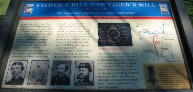
In September 1864, Union Gen. Philip H. Sheridan detached two cavalry divisions under Gen. Alfred T. A. Torbert to move into the Page Valley. While the bulk of Sheridan’s army would strike Gen. Jubal A. Early’s Confederates at Fisher’s Hill, Torbert was to cross Massanutten Mountain and cut off Early’s avenue of retreat.
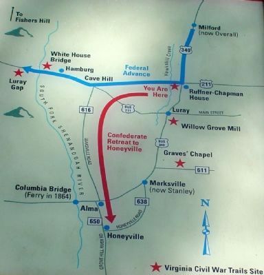
This maneuver first met resistance from well-entrenched Confederate cavalry at Milford (present-day Overall) on September 22. Unsuccessful at breaking the line, Torbert withdrew to Front Royal. By September 24, however, Torbert had learned of Sheridan’s victory at Fisher’s Hill and quickly marched towards Luray, catching up with remnants of Confederate cavalry under Col. William H. Payne here around Yager’s Mill.
Gen. George A. Custer and Col. Charles R. Lowell, Jr. attacked Payne’s brigade with two Federal cavalry brigades and artillery. Badly outnumbered and outgunned, the Confederates retreated to Honeyville before moving on to Port Republic.
Although Torbert continued across Massanutten Mountain, he was too late to cut off the Confederate retreat. Years after the war, Sheridan recollected that he could never “account satisfactorily for Torbert’s failure.”
(sidebar) Private Phillip James Baybutt, a native Englishman and member of the 2nd Massachusetts Cavarly, received this Medal of Honor for seizing the regimental flag of the 6th Virginia Cavalry in action here. Despite having received this distinction, Baybutt was denied a veteran’s pension following his return to England after the war.
Erected by Summers-Koontz Camp #490, with the aid of a grant from the Shenandoah Valley Battlefields Foundation and support from the town of Luray.
Topics and series. This historical marker is listed in this topic list: War, US Civil. In addition, it is included in the Virginia Civil War Trails series list. A significant historical month for this entry is September 1864.
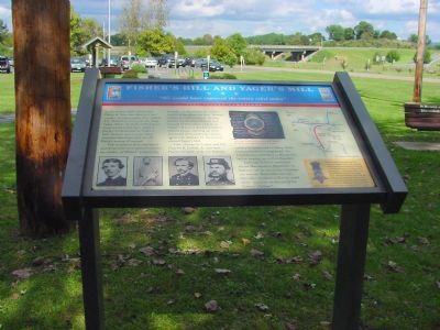
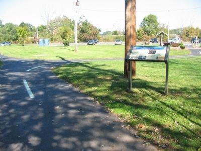
Location. 38° 40.281′ N, 78° 27.442′ W. Marker is in Luray, Virginia, in Page County. Marker is on North Board Street (Business U.S. 340) south of Lee Highway (U.S. 211), on the left when traveling north. Marker is at the Luray Hawksbill Greenway park, near the water fountain. Touch for map. Marker is in this post office area: Luray VA 22835, United States of America. Touch for directions.
Other nearby markers. At least 8 other markers are within walking distance of this marker. Cavalry Engagement (within shouting distance of this marker); The Chapman-Ruffner House (approx. 0.2 miles away); Luray, Virginia Established 1812 (approx. half a mile away); White House Ferry (approx. half a mile away); Confederate Memorial (approx. half a mile away); Massanutten School (approx. half a mile away); A Slave Auction Block (approx. half a mile away); Mt. Carmel Baptist Church (approx. half a mile away). Touch for a list and map of all markers in Luray.
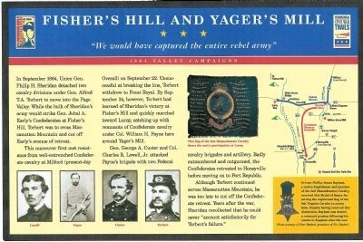
More about this marker. In the upper center is a photo of a regimental flag. This flag of the 2nd Massachusetts Cavalry shows the unit's participation at Luray. In the lower left are portraits of Lowell, Payne, Custer, and Torbert. On the right is a campaign map showing the respective unit movements. A photo of the Medal of Honor is in the sidebar.
Regarding Fisher’s Hill and Yager’s Mill. This marker is one of several detailing Civil War activities in Page County, Virginia. Please see the Page County Civil War Markers link below.
Also see . . .
1. Page County Civil War HMDb Markers. (Submitted on February 25, 2009, by Craig Swain of Leesburg, Virginia.)
2. Avenue of Armies: Civil War Sites and Stories of Luray and Page County, Virginia. (Submitted on March 20, 2009, by Robert H. Moore, II of Winchester, Virginia.)
Additional commentary.
1. Notes on the Battle
The actual battle site is a few miles to the north, and actually north of the old Yager's Mill site.
From pp. 99-100, "Avenue of Armies: Civil War Sites and Stories of Luray and Page County, Virginia," (2002) by Robert H. Moore, II:
As Union cavalry under Wesley Merritt closed in on Luray, Payne's Confederate brigade, ordered to return to Milford and unaware of Merritt's progress beyond Springfield, came into contact with Merritt's troopers.
Payne quickly dismounted the 5th and 6th Virginia Cavalry and placed them on the right behind fence rails along the Luray Road, while the 15th Virginia Cavalry was held mounted to the left of the road, in the direction of Yager's Mill and "concealed by a small skirt of woods and a high fence." As the Federals moved in, they brought their artillery into battery atop a height overlooking the Confederate position and began to open up. Shortly thereafter, Gen. George A. Custer, leading the 6th Michigan and two squadrons of the 2nd Massachusetts, descended from the Federal left while the 1st Michigan thundered down the main road. A mounted squadron of the 6th Virginia was ordered to countercharge but was quickly overcome by blue troopers to their left and rear. Realizing the severity of the situation many of the Confederate officers began to tell their men to save themselves.
In less than a half hour, the Federal advance at Yager's Mill had pushed the Confederates toward New Market Gap, with several men taking the old Luray to Staunton Turnpike (Leaksville Road) and Blue Ridge Turnpike toward Honeyville. There, Payne's men rallied and prepared for another attack which did not come.
— Submitted February 6, 2009, by Robert H. Moore, II of Winchester, Virginia.
Credits. This page was last revised on August 22, 2022. It was originally submitted on January 6, 2007. This page has been viewed 3,907 times since then and 43 times this year. Last updated on September 8, 2020, by Bradley Owen of Morgantown, West Virginia. Photos: 1. submitted on October 4, 2008, by Craig Swain of Leesburg, Virginia. 2. submitted on January 13, 2009, by Robert H. Moore, II of Winchester, Virginia. 3, 4, 5. submitted on January 6, 2007, by J. J. Prats of Powell, Ohio. 6. submitted on October 4, 2008, by Craig Swain of Leesburg, Virginia. • J. Makali Bruton was the editor who published this page.
