Marker Logo HMdb.org THE HISTORICAL
MARKER DATABASE
“Bite-Size Bits of Local, National, and Global History”
Cumberland Gap in Claiborne County, Tennessee — The American South (East South Central)
 

Three States Cornerstone

1˝ mi.


Three States Cornerstone Marker image. Click for full size.
Photographed By Tom Bosse, May 29, 2011
1. Three States Cornerstone Marker
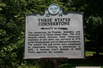
Inscription. The cornerstone for Virginia, Kentucky, and Tennessee is on Three States Peak. The first Virginia - North Carolina (later Tennessee) boundary at this point was surveyed in 1779 by Dr. Thomas Walker and Col. Richard Henderson. The present line and corner were established by compromise following a controversy in 1802. A Supreme Court decision in 1903 finally approved the location.
 
Erected by Tennessee Historical Commission. (Marker Number 1D14.)
 
Topics and series. This historical marker is listed in this topic list: Colonial Era. In addition, it is included in the Tennessee Historical Commission series list. A significant historical year for this entry is 1779.
 
Location. 36° 36.024′ N, 83° 40.097′ W. Marker is in Cumberland Gap, Tennessee, in Claiborne County. Marker is at the intersection of Pennlyn Ave. and Llewelyn Street, on the right when traveling north on Pennlyn Ave.. Touch for map. Marker is in this post office area: Cumberland Gap TN 37724, United States of America. Touch for directions.
 
Other nearby markers. At least 8 other markers are within walking distance of this marker. Russell Berkau 1867 - 1936 (within shouting distance of this marker); On Guard in Cumberland Gap (about 300 feet away, measured in a direct line in Virginia); Iron Furnace (about 400 feet away in Virginia); Gateway to Kaintuck
Paid Advertisement
Click on the ad for more information.
Please report objectionable advertising to the Editor.
Click or scan to see
this page online
(about 400 feet away in Virginia); Hiking in the Gap (about 400 feet away in Virginia); Cumberland Gap (about 700 feet away); Warriors' Path (approx. 0.2 miles away in Virginia); Gap Cave (approx. 0.2 miles away in Virginia).
 
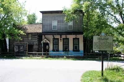
Three States Cornerstone Marker image. Click for full size.
Photographed By Tom Bosse, May 29, 2011
2. Three States Cornerstone Marker
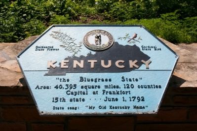
Kentucky image. Click for full size.
Photographed By Tom Bosse, May 29, 2011
3. Kentucky
The Bluegrass State
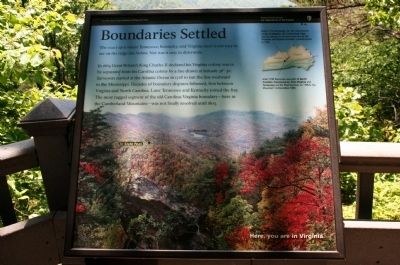
Boundaries Settled image. Click for full size.
Photographed By Tom Bosse, May 29, 2011
4. Boundaries Settled
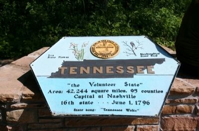
Tennessee image. Click for full size.
Photographed By Tom Bosse, May 29, 2011
5. Tennessee
The Volunteer State
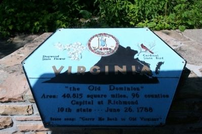
Virginia image. Click for full size.
Photographed By Tom Bosse, May 29, 2011
6. Virginia
The Old Dominion
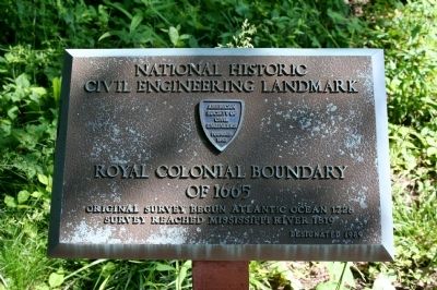
Royal Colonial Boundary of 1665 image. Click for full size.
Photographed By Tom Bosse, May 29, 2011
7. Royal Colonial Boundary of 1665
 
 
Credits. This page was last revised on June 26, 2022. It was originally submitted on January 11, 2015, by Tom Bosse of Jefferson City, Tennessee. This page has been viewed 1,107 times since then and 94 times this year. Last updated on June 24, 2022, by J. J. Prats of Springfield, Virginia. Photos:   1, 2, 3, 4, 5, 6, 7. submitted on January 11, 2015, by Tom Bosse of Jefferson City, Tennessee. • J. Makali Bruton was the editor who published this page.
Share this page.  
Share on Tumblr
m=200623

CeraNet Cloud Computing sponsors the Historical Marker Database.
This website earns income from purchases you make after using our links to Amazon.com. We appreciate your support.
Paid Advertisement
Apr. 25, 2024