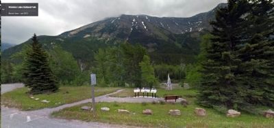
Near Waterton in Waterton Lakes National Park, Alberta — Canada’s Prairie Region (North America)
Western Canada's 1st Producing Oil Well
1er Puits De Pétrole Producteur de L'ouest Canadien
Inscription.
(Panel 1)
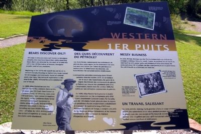
Bears Discover Oil?!
Oil seeps in this area were well known to Aboriginal peoples, who may have found them while observing bears. Bears are attracted by the smell of oil and may roll in it to rid themselves of insects. Aboriginal peoples used oil as a medicine.
Beginning in the 1870s the search was on for oil in western Canada. Drawing on Native lore, locals looked for oil seepages, and eventually found oil covered pools near here. This led to oil exploration in this area in the 1880s, followed by some commercial use of the oil.
In 1889, Allan Patrick became the first person to file a mineral claim on the oil seeps near Oil Creek (now known as Cameron Creek). In following years, over 150 land claims were staked throughout the region. Access problems likely foiled attempts to transport equipment to claims along Oil Creek. Several drilling attempts were made in the region, including one near Middle Waterton Lake - all failed. By 1893, drilling ended due to lack of expertise or money, and the claims were abandoned.
Messy Business
In 1898, William Aldridge was the first to commercially use oil from the seepages, making a living for nearly 7 years. He acquired the oil mainly by soaking it up with gunny sacks and skimming it from sluice boxes. He produced about 10-15 gallons per day, transporting it out on pack horses. He sold it locally as a lubricant and medicine.
[Captions:]
Wildlife tracks are common in the oil-saturated ground surrounding oil pools in this area.
The Aldridge family lived near Middle Waterton Lake, later moving to Oil Creek. When the boom ended, they relocated to Cardston.
Glenbow Archives NC-7-451
(Panel 2)
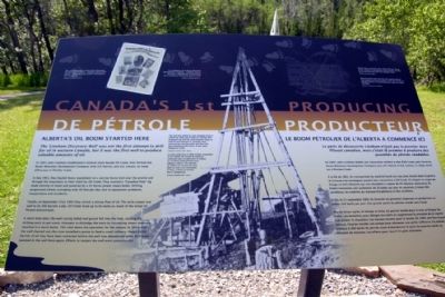
Alberta's Oil Boom Started Here
The 'Lineham Discovery Well' was not the first attempt to drill for oil in western Canada, but it was the first well to produce saleable amounts of oil.
In 1897, John Lineham established a mineral claim beside Oil Creek, then formed the Rocky Mountain Development Company with A.P. Patrick, and G.K. Leeson. Its head office was in Pincher Creek.
In late 1901, they hauled heavy equipment on a narrow horse trail over the prairie and through the mountains to their claim by Oil Creek. They erected a “Canadian Pole” rig made entirely of wood and powered by a 35 horse-power steam boiler. Drilling progressed slowly, averaging only 30 feet per day, due to equipment problems,
inexperience and accidents.
Finally, on September 21st, 1902 they struck a strong flow of oil. The early output was said to be 300 barrels a day. Oil Creek lived up to its name as much of the initial oil flowed downstream.
A short time later, the well casing failed and gravel fell into the hole, causing the drilling tools to get stuck. Attempts to dislodge the tools by increasing steam pressure resulted in a burst boiler. This shut down the operation for the season. In 1904, with the well cleaned out, the crew installed a pump to feed a small refinery. About 8,000 barrels of oil may have been extracted before the well was abandoned when drill tools jammed in the well bore again. Efforts to reopen the well were unsuccessful.
[Caption:]
The well was drilled by tools hanging from a tripod rig. Rock was broken by raising then dropping the drill bit, with frequent stops to pull out and sharpen it. Cuttings were removed by pouring water into the hold, then hauling up the slurry. It was slow, dangerous work.
Glenbow Archives NA-1 585-3
(Panel 3)
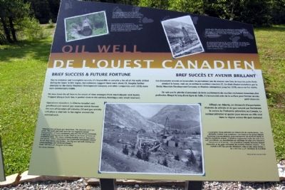
Brief Success & Future Fortune
Due to mistaken and incomplete records, it's impossible to compile a list of all the wells drilled during the boom in this region, but estimates suggest there were about 25. Despite further attempts by the Rocky Mountain
Development Company and other companies until 1939, none were commercially viable.
We now know the oil here is the result of slow seepages from much deeper rock layers. Trapped along a fault line, it pooled close to the surface, forming a very small reservoir.
Operations elsewhere in Alberta revealed vast petroleum and natural gas reserves which formed the core of Canada's oil industry. Oil and gas activity still plays a vital role in the region around the national park.
[Captions:]
Over time, machinery and buildings deteriorated. A clean up was held here in 1942 as part of a wartime scrap metal drive, and the government carried out further clean ups in the 1960s for safety reasons.
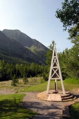
Shortly after the well site was declared a national historic site in 1965, a monument incorporating the embedded drill tools was installed. The monument evokes the style of later drilling rigs seen in this 1932 photograph.
Glenbow Archives NA-700-3
“Alberta's first oil boom was short-lived…The obstacles were too great. The roads and trails were far too rugged to permit transportation of heavy equipment, and once the oil was extracted, it had to be transported out of the “field' on the backs of mules at prohibitive costs. The closest refining facilities were at Vancouver and Sarnia… Initial investments were expended and people
refused to risk their money any further...Oil City was left with nothing but empty buildings and shattered dreams.”
From “Oil City”, J.F. Dormaar & R.A. Watt
W.B. Curzon 1928 photo
(Panel 1)
Des Ours Découvrent Du Pétrole?
Les Autochtones connaissaient les suintements de pétrole dans cette région car ils observaient les ours. Les ours sont attirés par l'odeur du pétrole et s'y roulent pour se débarrasser des insectes. Les Autochtones s'en servaient comme médicament.
La prospection pétrolière commença dans l'Ouest canadien dans les ann ées 1870. En se fondant sur le savoir des Autochtones, les gens de la région cherche`rent des suintements de p étrole et finirent par trouver des gisements pr`s d'ici. L'exploration, lanc ée dans les ann ées 1880, fut suivie par une utilisation commerciale du pétrole.
En 1889, Allan Patrick fut le premier à établir une concession sur les suintements près d'Oil Creek (maintenant Cameron Creek). Par la suite, plus de 150 claims furent jalonnés dans la région. Les probèmes d'accès empêchèrent probablement le transport de matèriel le long d'Oil Creek. Plusieurs tentatives de forage, y compris une près du lac Wateron moyen échouèrent, et les travaux cessèrent en 1893 en raison du manque d'expertise ou d'argent.
Un Travail Salissant
En
1898, William Aldridge fut le premier à faire un usage commercial du pètrole des suintements et en vécut pendant presque sept ans. Il absorbait le pétrole avec des sacs en jute et l'écrémait de sluices. Il produisait environ 10 à 15 gallons par jour, qu'il tranportait à dos de cheval et vendait comme lubrifiant et m&eactue;dicament.
(Upper Photo Caption)
Les empreintes d'animaux sont courantes dans le soil saturé de pétrole autour des gisements dans cette région
(Lower Right Photo Caption)
La famille Aldridge vécut près du lac Waterton moyen, puis à Oil Creek. Elle déménagea à Cardston après le boom
Archives Glenbow NC-7-451
(Panel 2)
Le Boom Pétrolier De L'Alberta A Commencé Ici
Le puits de découverte Lineham n'était pas le premier dans l'Ouest candien, mais c'était le premier à produire des quantités de pétrole vendables.
En 1897, John Lineham établit une concession minière côté d'Oil Creek, puis forme la Rocky Mountain Development Company avec A.P. Patrick et G.K. Leeson. Le siège social est à Pincher Creek.
À la fin de 1901, ils transportent du matériel lourd sur une piste étroite dans la prairie et à travers les montagnes jusqu'à leur concession à Oil Creek. Ils érigent un engin de forage en bois alimenté par une chaudière à vapeur de 35 chevaux-puissance. Ils forent lentement, soit seulement de 30 pieds par jour en moyenne, à cause des problèriel, du manque d'expèrience et des accidents.
Enfin, le 21 septembre 1902, ils trouvent un gisement important et produisent au début 300 barils par jour. Une grande partie du pétrole coulait vers l'aval.
Peu de temps après, le tubage se brise, du gravier tombe dans le trou et bioque les outils. Les tentatives pour déloger les outils en augmentant la pression de la vapeur font èclater la chaudière. Les travaux cessent pour la saison. En 1904, une foise le puite nettoyé, l'équipe instalie une pompe pour alimenter une petite raffinerie. On extrait quelque 8 000 barils de pétrole avant d'abandonner le puits lorsque les outils se coincent de nouveau. Les efforts pour rouvrir le puits échouent.
(Center Photo Caption)
Le puits était foré à l'aide d' outils suspendus à un trépied. On brisait la roche en soulevant puls en abaissant le trépan, en arrétant fréquemment pour aiguiser celul-ci. On enlevait les débris en versant de l'eau dans le trou et en remontant la boue. C'était un travail lent et dangereux.
Archives Glenbow NA-1 585-3
(Panel 3)
Bref Succès Et Avenir Brillant
Les documents erronés et incomplets ne permettent pas de dresser une liste de tous les puits forés pendant le boom, mais on en estime le nombre à environ 25. En dépit d'autre tentatives par la Rocky Mountain Development Company et d'autres entrepreises jusqu'en 1939, aucun ne fut viable.
On sait que le pétrole ici provenait de lents suintements de couches rocheuses beaucoup plus profondes. Bloqué le long d'une ligne de faille, il s'accumulair près de la surface pour former un très petit réservoir.
Ailleurs en Alberta, on découvrit d'importantes réserves de pétrole et de gaz naurel qui formèrent le centre de l'industrie pétrolière au Canada. Le secteur pétrolier et grazier joue encore un rôle vital dans la région autour du parc national.
(Upper Left Photo Caption)
Les machines et les bâtiments se détériorérent. Un nettoyage eu lieu en 1942 dans le cadre de la collecte de ferraille pendant la guerre, et le gouvernement mena d'autres nettoyages dans les années 1960 pour des raisons de sécurité.
(Upper Right Photo Caption)
Un monument intégrant les outils de forage fut érigé peu de temps après que l'emplacement du puits ait été désigné lieu historique national en 1965. Il évoque le style des engins de forage dans cette photo de 1932.
Archives Glenbow NA-700-3
(Lower Photo Caption)
“Le premier boom pétrolier en Alberta fut de courte durée... Les obstacles étaient trop nombreux. Les routes et les pistes étaient beaucoup trop accidentées pour transporter du matériel lourd, et une fois le pétrole extrait, il fallait le transporter à dos de mule à un coût exorbitant. Les installations de raffinage les plus près étaient dépensées et les gens refusaient de prendre d'autres riques... Il ne restait à Oil City que des bâtiments vides et des rêves brisés.”
De “Oil City”, J.F. Dormaar et R.A. Watt
Photo de W.B. Curzon 1928
Topics. This historical marker is listed in this topic list: Industry & Commerce. A significant historical month for this entry is September 1908.
Location. 49° 4.273′ N, 113° 59.223′ W. Marker is near Waterton, Alberta, in Waterton Lakes National Park. Marker can be reached from Akamina Parkway, 7 kilometers west of Alberta Highway 5, on the left when traveling west. Marker is located in the Cameron Valley in Waterton Lakes National Park. Touch for map. Marker is in this post office area: Waterton AB T0K 2M0, Canada. Touch for directions.
Other nearby markers. At least 3 other markers are within 6 kilometers of this marker, measured as the crow flies. Dream Town (approx. 1.2 kilometers away); Waterton (approx. 5.6 kilometers away); Oil & Architecture (approx. 5.6 kilometers away).
Credits. This page was last revised on March 4, 2024. It was originally submitted on January 15, 2015, by Duane Hall of Abilene, Texas. This page has been viewed 530 times since then and 33 times this year. Last updated on March 4, 2024, by Carl Gordon Moore Jr. of North East, Maryland. Photos: 1, 2, 3, 4, 5, 6. submitted on January 15, 2015, by Duane Hall of Abilene, Texas. • Devry Becker Jones was the editor who published this page.
