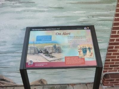
On Alert
Star-Spangled Banner National Historic Trail
— War of 1812 —
Port Deposit was spared, perhaps due to its well-defended battery. Or, as legend claims, enemy raiders heard that the defenders could “shoot an eye out of a crow upon the wing.”
Exploit and Explore
Rear Admiral George Cockburn led a British squadron to the head of the Bay in 1813 to harass coastal towns and destroy American supplies. They also charted local waters, gathering information to use when they returned the following year.
“I detached a small division of Boats up the Susquehanna to take and destroy whatever they might meet with in it.”
- British Rear Admiral George Cockburn to Admiral John B. Warren, May 3, 1813
(Inscription beside the image on the left)
A gun battery at Port Deposit, visible from the water, may have deterred British raiders from attacking the town.
Image / (c) Gerry Embleton
(Inscription under the image on the bottom right)
Cockburn (foreground) in 1814 depiction of British raid on Havre de Grace
Image / courtesy Maryland Historical Society, H151
Erected by National Park Service-United States Department of the Interior.
Topics and series.
Location. 39° 36.276′ N, 76° 6.918′ W. Marker is in Port Deposit, Maryland, in Cecil County. Marker is on S. Main Street (Maryland Route 222), on the left when traveling north. The marker is next to the side wall of the U.S. Post Office in Port Deposit. Touch for map. Marker is at or near this postal address: 5 South Main Street, Port Deposit MD 21904, United States of America. Touch for directions.
Other nearby markers. At least 8 other markers are within walking distance of this marker. The River Town (within shouting distance of this marker); Gerry House (within shouting distance of this marker); John A. J. Creswell (within shouting distance of this marker); Jacob Tome, Town Father (within shouting distance of this marker); Snow's Battery (about 300 feet away, measured in a direct line); a different marker also named Snow’s Battery (about 300 feet away); Adams Hall (approx. 0.2 miles away); Washington Hall (approx. 0.2 miles away). Touch for a list and map of all markers in Port Deposit.
Credits. This page was last revised on March 1, 2020. It was originally submitted on January 17, 2015, by Don Morfe of Baltimore, Maryland. This page has been viewed 501 times since then and 29 times this year. Last updated on February 29, 2020, by Carl Gordon Moore Jr. of North East, Maryland. Photos: 1, 2. submitted on January 17, 2015, by Don Morfe of Baltimore, Maryland. • Bill Pfingsten was the editor who published this page.

