Gnadenhutten in Tuscarawas County, Ohio — The American Midwest (Great Lakes)
Gnadenhutten / The Gnadenhutten Massacre, "A Day of Shame"
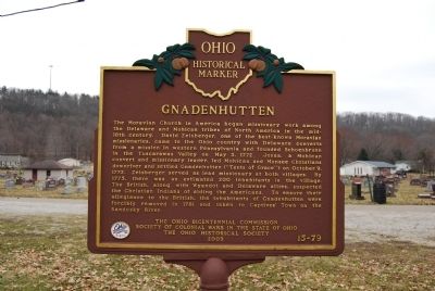
Gnadenhutten
The Moravian Church in America began missionary work among the Delaware and Mohican tribes of North America in the mid-18th century. David Zeisberger, one of the best-known Moravian missionaries, came to the Ohio country with Delaware converts from a mission in western Pennsylvania and founded Schoenbrunn in the Tuscarawas Valley on May 3, 1772. Josua, a Mohican convert and missionary leader, led Mohican and Munsee Christians downriver and settled Gnadenhutten ("Tents of Grace") on October 9, 1772. Zeisberger served as lead missionary at both villages. By 1775, there was an estimated 200 inhabitants in the village. The British, along with Wyandot and Delaware allies, suspected the Christian Indians of aiding the Americans. To ensure their allegiance to the British, the inhabitants of Gnadenhutten were forcibly removed in 1781 and taken to Captives' Town on the Sandusky River.
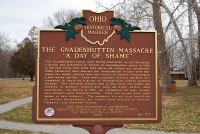
The Gnadenhutten Massacre, "A Day of Shame"
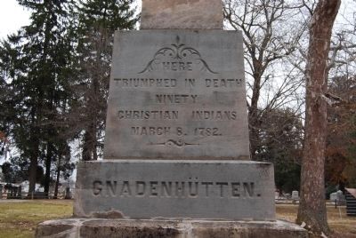
The Gnadenhutten Indians were facing starvation on the Sandusky. A group was permitted to return to Gnadenhutten early in 1782 to harvest crops that were left when the village was abandoned. While gathering their harvest the Gnadenhutten Indians were mistaken for Indian raiders who had struck in western Pennsylvania a few weeks earlier. They were captured without incident and sentenced to death by a group of Pennsylvania militia seeking revenge. The Christian Indians, men in one cabin and women and children in another, prayed and sang all night before their executions. On March 8, 1782, an estimated 90 men, women, and children were brutally killed. Only two young boys were known to have escaped. The massacre did not ease hostilities in western Pennsylvania, but fueled more attacks by Wyandot, Delaware, and Shawnee Indians.
Erected 2003 by The Ohio Bicentennial Commission, Society of Colonial Wars in the State of Ohio and The Ohio Historical Society. (Marker Number 15-79.)
Topics and series. This historical marker is listed in this topic list: Native Americans. In addition, it is included in the Ohio Historical Society / The Ohio History Connection series list. A significant historical month for this entry is March 1828.
Location. 40° 21.228′ N, 81° 26.061′ W. Marker is in Gnadenhutten, Ohio, in Tuscarawas County. Marker can be reached from South Cherry Street, 0.2 miles south of West Indian Street. Touch for map. Marker is in this post office area: Gnadenhutten OH 44629, United States of America. Touch for directions.
Other nearby markers. At least 8 other markers are within 6 miles of this marker, measured as the crow flies. The Ohio & Erie Canal in Warwick Township (approx. 3 miles away); Union Hall (approx. 4.8 miles away); Eckfield Square
(approx. 4.8 miles away); Uhrich's Mill 1806 / Clay Capital 1833-1980s (approx. 5.1 miles away); Uhrichsville (approx. 5.6 miles away); Dennison Railway Chapel / The Manse (approx. 6 miles away); Dennison Yard and Shops / Dennison Depot (approx. 6 miles away); Dennison High School (approx. 6 miles away).
Related markers. Click here for a list of markers that are related to this marker. To better understand the relationship, study each marker in the order shown.
Credits. This page was last revised on June 6, 2023. It was originally submitted on March 16, 2015, by Mike Wintermantel of Pittsburgh, Pennsylvania. This page has been viewed 1,491 times since then and 94 times this year. Last updated on June 2, 2023, by Grant & Mary Ann Fish of Galloway, Ohio. Photos: 1, 2, 3, 4, 5, 6. submitted on March 16, 2015, by Mike Wintermantel of Pittsburgh, Pennsylvania. • J. Makali Bruton was the editor who published this page.
