Near Manassas in Prince William County, Virginia — The American South (Mid-Atlantic)
Second Battle of Manassas
Confederate Skirmish Line, Afternoon of August 30, 1862
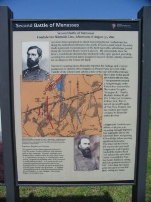
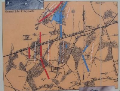
Narrowly escaping injury, Reynolds reported his findings and received permission to shift his three brigades of Pennsylvania Reserves to the vicinity of the Chinn Farm (about a mile to the east) where theoretically they could better guard the Union left and rear. This movement created a dangerous gap in the Union lines south of the Warrenton Turnpike. To support Lt. Charles Hazlett's Battery D, 5th U.S. Artillery at Groveton, Colonel G. K. Warren moved his small brigade of New York Zouaves into the position previously occupied by Reynolds' entire division.
Longstreet's Confederates advanced at 4:00 p.m. smashing through Warren's two regiments east of the Groveton Road and gaining Chinn Ridge before meeting significant resistance. The attack on the Union left was not checked until Longstreet's lead brigades reached the Sudley Road 1-1/2 miles to the east where Union General John Pope had hastily formed a strong defensive position on Henry Hill. After dark the Union army retreated across Bull Run, ending the battle.
The regiment was the basic organizational unit of Civil War armies. Soldiers identified with and took pride in their regiments. Volunteer regiments were designated by a number and by the state which raised it. A regiment was composed of a headquarters staff and ten companies identified by letters A-K (J not used to avoid confusion with I). At its initial muster each company would have 100 men with officers, but frequently effective strength was severely diminished by battle losses, disease, and desertions. To facilitate command and control, up to five regiments could be grouped together to form a brigade. Two to four brigades formed a division.
Erected by Manassas National Battlefield Park - Department of the Interior.
Topics. This historical marker is listed in this topic list: War, US Civil. A significant historical year for this entry is 1862.
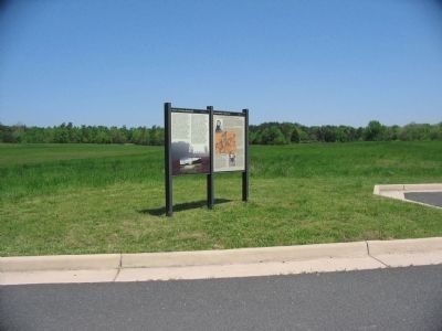
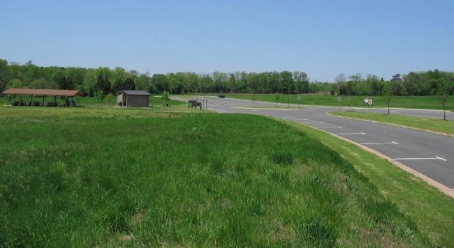
Location. 38° 48.242′ N, 77° 33.125′ W. Marker is near Manassas, Virginia, in Prince William County. Marker is on William Center Boulevard, on the right when traveling west. Located in the picnic area parking lot in the Manassas Battlefield National Park. The area is reached off Groveton Road. Touch for map. Marker is in this post office area: Manassas VA 20109, United States of America. Touch for directions.
Other nearby markers. At least 8 other markers are within walking distance of this marker. Historic Landscape Restoration (here, next to this marker); Brownsville (approx. ¼ mile away); Confederate Counterattack (approx. 0.6 miles away); Battery Heights (approx. 0.6 miles away); Manassas National Battelfield Park (approx. 0.6 miles away); 10th New York Vol. Infantry (approx. 0.6 miles away); "The Very Vortex of Hell" (approx. 0.6 miles away); a different marker also named Battery Heights (approx. 0.6 miles away). Touch for a list and map of all markers in Manassas.
More about this marker. In the upper right is a portrait of General Reynolds. In the lower left is a portrait of General Longstreet. The center of the marker contains a map indicating the location of the skirmish lines and other forces discussed in the text.
Also see . . . Manassas National Battlefield Park. National Park Service site. (Submitted on June 18, 2008, by Craig Swain of Leesburg, Virginia.)
Credits. This page was last revised on August 15, 2022. It was originally submitted on June 18, 2008, by Craig Swain of Leesburg, Virginia. This page has been viewed 1,524 times since then and 44 times this year. Last updated on August 15, 2022, by Carl Gordon Moore Jr. of North East, Maryland. Photos: 1, 2. submitted on June 18, 2008, by Craig Swain of Leesburg, Virginia. 3. submitted on June 17, 2008, by Craig Swain of Leesburg, Virginia. 4. submitted on June 18, 2008, by Craig Swain of Leesburg, Virginia. • Bernard Fisher was the editor who published this page.


