Near New Market in Madison County, Alabama — The American South (East South Central)
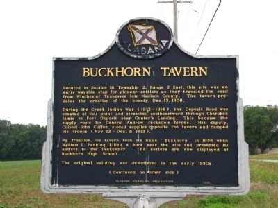
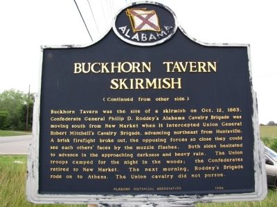
Buckhorn Tavern / Buckhorn Tavern Skirmish
During the Creek Indian War (1813-1814), the Deposit Road was created at this point and stretched southeastward through Cherokee lands to Fort Deposit near Gunter's Landing. This became the supply route for General Andrew Jackson's forces. His deputy, Colonel John Coffee, stored supplies opposite the tavern and camped his troops (Nov. 22 - Dec. 8, 1813).
By tradition, the tavern took its name "Buckhorn" in 1858 when William L. Fanning killed a buck near the site and presented its antlers to the innkeeper. The antlers are now displayed at Buckhorn High School.
The original building was demolished in the early 1950s.
(Continued on other side)
(Continued from other side)
Buckhorn Tavern was the site of a skirmish on Oct. 12, 1863. Confederate General Philip D. Roddey's Alabama Cavalry Brigade was moving south from New Market when it intercepted Union General Robert Mitchell's Cavalry Brigade, advancing northeast from Huntsville. A brisk firefight broke out, the opposing forces so close they could see each other's faces by the muzzle flashes. Both sides hesitated to advance in the approaching darkness and heavy rain. The Union troops camped for the night in the woods; the Confederates retired to New Market. The next morning, Roddey's Brigade rode on to Athens. The Union cavalry did not pursue.
Erected 1996 by Alabama Historical Association.
Topics and series. This historical marker is listed in these topic lists: Notable Places • Settlements & Settlers • War, US Civil. In addition, it is included in the Alabama Historical Association, and the Former U.S. Presidents: #07 Andrew Jackson series lists. A significant historical date for this entry is December 13, 1808.
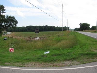
Location. 34° 52′ N, 86° 27.317′ W. Marker is near New Market, Alabama, in Madison County. Marker is at the intersection of Winchester Road and Maysville Road, on the left when traveling south on Winchester Road. Touch for map. Marker is in this post office area: New Market AL 35761, United States of America. Touch for directions.
Other nearby markers. At least 8 other markers are within 6 miles of this marker, measured as the crow flies. Madison County Poorhouse Farm Site and Cemetery (approx. 3 miles away); Site of Bell Factory (approx. 3 miles away); New Market Presbyterian Church (approx. 3.3 miles away); Town of New Market (approx. 3.4 miles away); Mount Paran Campground and Cemetery (approx. 3.9 miles away); Site of Quick Airplane (approx. 4˝ miles away); Original Site of Enon Baptist Church (approx. 5.6 miles away); Early Settlers Cemetery (approx. 5.8 miles away). Touch for a list and map of all markers in New Market.
Credits. This page was last revised on August 19, 2020. It was originally submitted on June 9, 2010, by Lee Hattabaugh of Capshaw, Alabama. This page has been viewed 3,467 times since then and 113 times this year. Last updated on August 19, 2020, by Duane and Tracy Marsteller of Murfreesboro, Tennessee. Photos: 1, 2, 3. submitted on June 9, 2010, by Lee Hattabaugh of Capshaw, Alabama. • Mark Hilton was the editor who published this page.


