Near Avalon in Baltimore County, Maryland — The American Northeast (Mid-Atlantic)
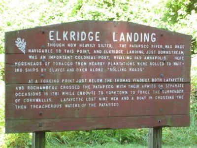
Elkridge Landing
At a fording point just below the Thomas Viaduct both Lafayette and Rochambeau crossed the Patapsco with their armies on separate occasions in 1781 while enroute to Yorktown to force the surrender of Cornwallis. Lafayette lost nine men and a boat in crossing the treacherous waters of the Patapsco.
Topics. This historical marker is listed in these topic lists: Colonial Era • Industry & Commerce • War, US Revolutionary. A significant historical year for this entry is 1781.
Location. 39° 13.66′ N, 76° 43.367′ W. Marker is near Avalon, Maryland, in Baltimore County. Marker can be reached from the intersection of Washington Boulevard (U.S. 1) and South Street. Marker is within the Patapsco Valley State Park - Avalon area, on the northern side of the Patapsco River, just under 1 mile from the park gate building, and about 500 feet from the Avalon Visitor Center parking lot. Entrance to PVSP is about 300 feet north of the US 1 - South Street intersection. Touch for map. Marker is in this post office area: Halethorpe MD 21227, United States of America. Touch for directions.
Other nearby markers. At least 8 other markers are within walking distance of this marker. Powering the Patapsco Valley's Industries (about 300 feet away, measured in a direct line); A Place For Progress (about 400 feet away); Iron Builds America (about 400 feet away); The C.C.C. Builds Our Park (about 400 feet away); Forging Freedom and Nails (about 600 feet away); Drinking Water for the Public (about 700 feet away); The Baltimore County Water and Electric Company (approx. 0.2 miles away); Patapsco Valley State Park (approx. ¼ mile away). Touch for a list and map of all markers in Avalon.
Regarding Elkridge Landing. There are two identical Maryland historical roadside markers titled "Elk Ridge Landing" in Elkridge, Maryland, about 1 mile south of this marker. About 3.5 miles north of here is a "Rolling Road" marker at the intersection of Frederick Road and Rolling Road.

Photographed By F. Robby, July 1, 2008
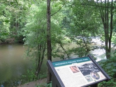
3. Patapsco Valley State Park Marker
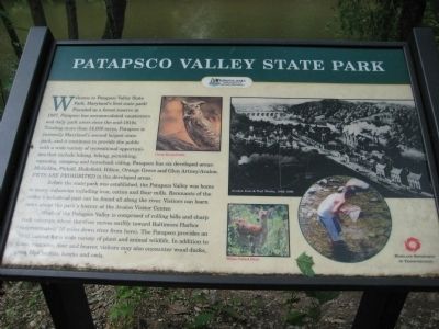
This PVSP informational marker is about 1/4 mile southeast of the Elkridge Landing marker, on the southern side of the river, at a free pedestrian or bike entrance to the park at River Road and Rockburn Hill Road. Normal daily fee to enter the park by car at the South Street entrance is $2.
Credits. This page was last revised on February 8, 2021. It was originally submitted on July 5, 2008, by F. Robby of Baltimore, Maryland. This page has been viewed 1,842 times since then and 78 times this year. Last updated on February 7, 2021, by Carl Gordon Moore Jr. of North East, Maryland. Photos: 1, 2, 3, 4. submitted on July 5, 2008, by F. Robby of Baltimore, Maryland. • Bill Pfingsten was the editor who published this page.


