Fort Myers in Lee County, Florida — The American South (South Atlantic)
Edisonís Water Systems
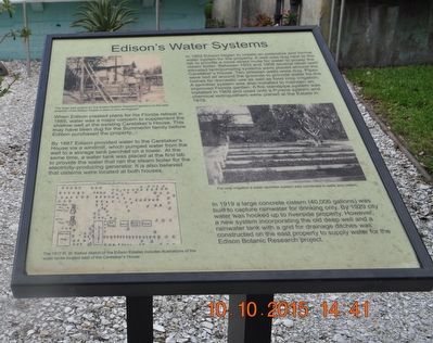
When Edison created plans for his Florida retreat in 1885, water was a major concern to supplement the shallow well at the existing Caretakerís House. This may have been dug for the Summerlin family before Edison purchased the property.
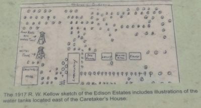
By 1887 Edison provided water to the Caretakerís House via a windmill, which pumped water from the well to a storage tank perched on a tower. At the same time, a water tank was placed at the first lab to provide the water that ran the steam boiler for the electricity-producing generator. It is also believed that cisterns were located at both houses.
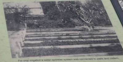
In 1902 Edison began to create an extensive and formal water system for the property. A well was dug next to the lab to provide a more direct route for water to power the steam boiler. Between 1903 and 1908 several other well/elevated tank/pumping systems were placed around the Caretakerís House. Two artesian wells were dug. Pipes were laid all around the grounds to provide water for the homes for domestic use as well as food crop irrigation. A sprinkler system was also installed to maintain an improved Florida garden. A fire sandpipe system was installed in 1909 and used until a Pyrene system and chemical extinguishers were placed at the Estate in 1919.
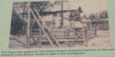
In 1919 a large concrete cistern (40,000 gallons) was built to capture rainwater for drinking only. By 1929 city water was hooked up to riverside property. However, a new system incorporating the old deep well and a rainwater tank with a grid for drainage ditches was constructed on the east property to supply water for Edison Botanic Research project.
Topics. This historical marker is listed in these topic lists: Charity & Public Work • Natural Resources. A significant historical year for this entry is 1885.
Location. 26° 38.067′ N, 81° 52.804′ W. Marker is in Fort Myers, Florida, in Lee County. Marker can be reached from McGregor Boulevard south of Larchmont Avenue, on the right when traveling south. The marker is inside the Edison & Ford Winter Estates. Touch for map. Marker is at or near this postal address: 2350 McGregor Blvd, Fort Myers FL 33901, United States of America. Touch for directions.
Other nearby markers. At least 8 other markers are within walking distance of this marker. Edison Estate Restoration and Rebirth (here, next to this marker); Orchid Lane and Friendship Walk (here, next to this marker); Clara Fordís Michigan Rose Garden (here, next to this marker); Edisonís ďFlorida ParadiseĒ (here, next to this marker); Inside the Ford Home (here, next to this marker); Henry Ford (here, next to this marker); Henry Ford's Florida Estate (here, next to this marker); Edison Caretakerís House (here, next to this marker). Touch for a list and map of all markers in Fort Myers.
Also see . . .
Edison & Ford Winter Estates. (Submitted on November 6, 2015.)
Credits. This page was last revised on August 18, 2020. It was originally submitted on November 5, 2015, by Sandra Hughes Tidwell of Killen, Alabama, USA. This page has been viewed 252 times since then and 7 times this year. Photos: 1, 2, 3, 4. submitted on November 5, 2015, by Sandra Hughes Tidwell of Killen, Alabama, USA. • Bernard Fisher was the editor who published this page.


